Bitjug
|
Bitjug Битюг |
||
|
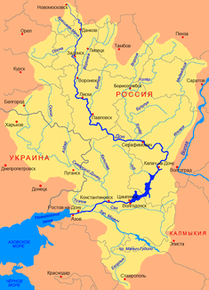
Location of the Bitjug (Битюг) in the catchment area of the Don |
||
| Data | ||
| Water code | RU : 05010100912107000003774 | |
| location | Oblast Tambov , Voronezh Oblast ( Russia ) | |
| River system | Don | |
| Drain over | Don → Black Sea | |
| source | at Tokarjowka 52 ° 1 ′ 8 ″ N , 41 ° 13 ′ 31 ″ E |
|
| muzzle | northwest of Pavlovsk in the Don Coordinates: 50 ° 37 ′ 33 " N , 39 ° 55 ′ 18" E 50 ° 37 ′ 33 " N , 39 ° 55 ′ 18" E
|
|
| length | 379 km | |
| Catchment area | 8840 km² | |
| Runoff at the Bobrow gauge |
MQ |
18.2 m³ / s |
| Left tributaries | Ertil | |
| Reservoirs flowed through | Cherkasskoye reservoir | |
| Medium-sized cities | Bobrov | |
| Small towns | Anna | |
|
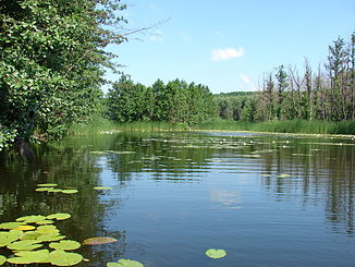
The Bitjug in summer |
||
The Bitjug ( Russian Битюг ) is a left tributary of the Russian Don in the Oka-Don plain .
It rises in the south of the Russian administrative unit Tambow near Tokarjowka . Its water initially flows west and then mostly south. It forms the Cherkasskoye reservoir south of Bobrov , and then flows into the Don about 60 km south of Bobrov. The river is regularly frozen over from mid-December to the end of March.
After this river, a breed of strong workhorses bred in the river basin is called the Bitjug horse .
Web links
Commons : Bitjug - collection of images, videos and audio files

