Bornberg (Palatinate)
| Bornberg | ||
|---|---|---|
|
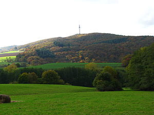
The Bornberg from the northeast |
||
| height | 520 m above sea level NN | |
| location | District of Kusel , Rhineland-Palatinate | |
| Mountains | North Palatinate Uplands | |
| Coordinates | 49 ° 33 '40 " N , 7 ° 32' 34" E | |
|
|
||
| rock | Kuselit | |
| particularities | 151 m high telecommunications tower, district waste dump of the Kusel district, solar park | |
The Bornberg is a 520 m high mountain in the Kusel district . It belongs to the North Palatinate Uplands . The Bornberg includes the two peaks "Kiefernkopf" and "Trautmannsberg". The Herrmannsberg joins in the northwest . The Talbach flows in the east, the Jettenbach in the southeast and the Reichenbach in the west. Surrounding places are Oberweiler im Tal , Eßweiler , Jettenbach and Bosenbach . The Schneeweiderhof, a district of Eßweiler, is located on the Bornberg.
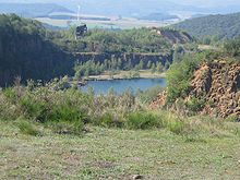
From 1840 onwards, several quarries were built on the Bornberg. From 1914 they were owned by Basalt AG, Linz am Rhein and in operation until 1970. The Schneeweiderhof , a district of Eßweiler, where many of the quarry workers lived , is closely connected to the quarries . In 1924 a workers' settlement, the "Kolonie", which still exists today, was built on the Schneeweiderhof. There was a school there between 1952 and 1965.
The district waste dump of the Kusel district has been located on the quarry site since 1988. The "Eßweiler" weather station of Meteomedia AG has also been located there since 2005 . In November 2008, in addition to the circular waste dump on the site of the former green waste collection point, a solar park with a capacity of 1.5 MW was put into operation on an area of four hectares. The operator is "Neue Energie Pfälzer Bergland GmbH", a joint venture between Pfalzwerke AG and the Kusel district.
The 151 m high Bornberg telecommunications tower of Deutsche Telekom stands on the Bornberg . a. several radio programs (FM and DAB) are broadcast. A natural gas pipeline, built in 1972 and expanded in 2003, runs across the Bornberg from the Netherlands to Italy.
In the run-up to the expansion of the natural gas pipeline, a Roman estate and traces of Celtic settlement were uncovered in 2002 during a rescue excavation on the southern slope of the Bornberg between Eßweiler, Jettenbach and Bosenbach.


