Borssele
 flag |
 coat of arms |
| province |
|
| local community |
|
|
Area - land - water |
11.35 km 2 11.23 km 2 0.12 km 2 |
| Residents | 1,425 (Jan. 1, 2019) |
| Coordinates | 51 ° 26 ' N , 3 ° 44' E |
| Important traffic route |
|
| prefix | 0113 |
| Postcodes | 4454 |
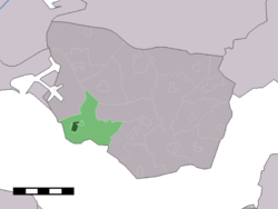
| Borssele village center is dark green, northwest of it the arm of the canal, where the nuclear power plant is located at the bottom | |
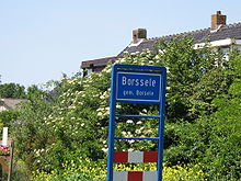
Borssele is a village of around 1400 inhabitants in the Dutch province of Zeeland . It belongs to the superordinate municipality of Borsele , which has the form of a scattered settlement with various municipalities, including Borssele.
Only about two kilometers from the village are located on the Scheldt , the Borssele nuclear power plant next to a coal plant of about the same power that their cooling water remove both this river.
The Borssele offshore wind farm is located in the North Sea .
Web links
Commons : Borssele - collection of images, videos and audio files
Individual evidence
- ↑ a b Kerncijfers wijken en buurten 2019. In: StatLine. Centraal Bureau voor de Statistiek , February 26, 2020, accessed April 7, 2020 (Dutch).

