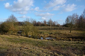
Braaker Au (Wandse)
| Braaker Au | ||
| Data | ||
| Water code | DE : 5956818 | |
| location | Stormarn district ( Schleswig-Holstein ) | |
| River system | Elbe | |
| Drain over | Wandse → Alster → Elbe → North Sea | |
| source | East of Braak 53 ° 37 ′ 1 ″ N , 10 ° 15 ′ 20 ″ E |
|
| Source height | 50 m above sea level NHN | |
| muzzle | Northwest of the Höltigbaum nature reserve in the Wandse Coordinates: 53 ° 37 '23 " N , 10 ° 12' 40" E 53 ° 37 '23 " N , 10 ° 12' 40" E |
|
| Mouth height | 37 m above sea level NHN | |
| Height difference | 13 m
|
|
| Communities | Braak | |
The Braaker Au is a brook in Schleswig-Holstein . It was named after the Braak parish through which it flows.
course
The Braaker Au rises in the Feldmark east of Braak, it runs predominantly in a westerly direction, crosses the northern part of the municipality and crosses under the federal highway 1 . Before and after the stream forms the southern end of the industrial area Stapelfeld / Braak. It leads immediately north past the Stapelfeld waste incineration plant and then through the Höltigbaum nature reserve (the former Höltigbaum training area ) until it reaches the state border with Hamburg on its north-western edge and flows into the Wandse there .

