Brentwood, New Hampshire
| Brentwood | ||
|---|---|---|
|
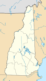
Location in New Hampshire
|
||
| Basic data | ||
| Foundation : | 1742 | |
| State : | United States | |
| State : | New Hampshire | |
| County : | Rockingham County | |
| Coordinates : | 42 ° 59 ′ N , 71 ° 4 ′ W | |
| Time zone : | Eastern ( UTC − 5 / −4 ) | |
| Residents : | 3,197 (as of: 2000) | |
| Population density : | 73.3 inhabitants per km 2 | |
| Area : | 44.0 km 2 (approx. 17 mi 2 ) of which 43.6 km 2 (approx. 17 mi 2 ) is land |
|
| Height : | 35 m | |
| Postal code : | 03833 | |
| Area code : | +1 603 | |
| FIPS : | 33-07220 | |
| GNIS ID : | 0873550 | |
| Website : | brentwood.town-center.org | |
Brentwood is a city ( town ) in New Hampshire and seating parts of the management of Rockingham County . Brentwood has 3,197 inhabitants (2000 census). Rockingham County Botanic Garden is in Brentwood .
geography
Brentwood is drained by the Piscassic , Little and Exeter Rivers . The place has an area of 44 km², of which 43.6 km² is land and 0.4 km² (0.94%) is water. The highest point in Brentwood is Great Hill ( Great Hill ) 84 m above sea level, located in the southeastern municipality.
history
Before Europeans settled in Brentwood, the areas around Brentwood were from the Abenaki tribe of Pennacook . When the English came to New Hampshire, Brentwood was part of Exeter and known as Brentwood Parish , named after the town of Brentwood in Essex , England , whose name is derived from Burnt Wood ( burned wood ).
