Brumovka
| Brumovka | ||
|
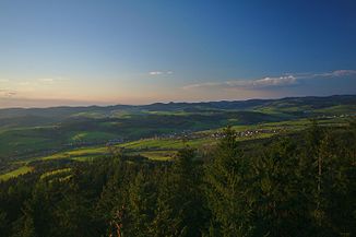
The valley of the river |
||
| Data | ||
| location | Czech Republic | |
| River system | Danube | |
| Drain over | Vlára → Waag → Danube → Black Sea | |
| source |
Horní Lideč 49 ° 10 ′ 26 ″ N , 18 ° 3 ′ 42 ″ E |
|
| Source height | 470 m nm | |
| muzzle | southwest of Bylnice in the Vlára coordinates: 49 ° 4 ′ 3 ″ N , 18 ° 0 ′ 12 ″ E 49 ° 4 ′ 3 ″ N , 18 ° 0 ′ 12 ″ E |
|
| Mouth height | 308 m nm | |
| Height difference | 162 m | |
| Bottom slope | 8.7 ‰ | |
| length | 18.7 km | |
| Catchment area | 86.5 km² | |
| Left tributaries | Nedašovka | |
The Brumovka (German Brumowka ), on the upper reaches also Klobučka , Valašskokloboucký potok and Kloboucký potok is a left tributary of the Vlára in the Czech Republic .
geography
The Brumovka rises in the north of the White Carpathians in the village of Študlov. It flows first over Valašské Příkazy , Poteč , Rybník and Valašské Klobouky to the southwest. There the river turns south. The villages Na Podskalí, Vlčí Potok, Brumov and Bylnice lie along its further course . The river flows into the Vlára to the southwest of Bylnice .
The Brumovka has a length of 18.7 kilometers. Its catchment area covers 86.5 km².
The Horní Lideč – Bylnice railway runs along the river as a branch line of the Wlara Railway .
Tributaries
- Dúbravka or Študlovský potok (l), Valašské Příkazy
- Vesník (l), Poteč
- Vlčí potok (r), Vlčí Potok
- Nedašovka, also Návojský potok (l), Brumov
- Tuřícký potok (l), Brumov
- Hložecký potok (r), Brumov
- Bylnička (l), Bylnice
Individual evidence
- ↑ http://www.journals.uzpi.cz/publicFiles/00241.pdf ( page no longer available , search in web archives ) Info: The link was automatically marked as defective. Please check the link according to the instructions and then remove this notice.
