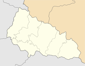
Bukivtsyovo
| Bukivtsyovo | ||
| Буківцьово | ||

|
|
|
| Basic data | ||
|---|---|---|
| Oblast : | Zakarpattia Oblast | |
| Rajon : | Velykyi Berezny district | |
| Height : | 430 m | |
| Area : | 40 km² | |
| Residents : | 235 (2001) | |
| Population density : | 6 inhabitants per km² | |
| Postcodes : | 89043 | |
| Area code : | +380 3135 | |
| Geographic location : | 48 ° 49 ' N , 22 ° 40' E | |
| KOATUU : | 2120880401 | |
| Administrative structure : | 1 village | |
| Address: | 89043 с. Буківцьово 46 | |
| Website : | City council website | |
| Statistical information | ||
|
|
||
Bukiwzjowo ( Ukrainian Буківцьово ; Russian Буковцево Bukowzewo , Slovak Bukovcová, Bukovec , Hungarian Ungbükkös, Ungbukóc ) is a village in the Ukrainian Transcarpathian Oblast with about 230 inhabitants (2001).
The village, founded in 1420 and first mentioned in writing in 1582, is the only place in the district council of the same name in the south of Velykyj Bereznyj district .
The locality is in the Waldkarpaten at an altitude of 430 m in the valley of Batschawy ( Бачави ) overlying the Ljutka ( Лютка of) Lyuta flows.
Bukiwzjowo is located 26 km southeast from Rajonzentrum Velykyi Bereznyi and 50 km northeast of the Oblastzentrum Uzhhorod .
Web links
Commons : Bukiwzjowo - collection of images, videos and audio files
- Bukiwzjowo on derev.org.ua (Ukrainian)
Individual evidence
- ↑ a b local website on the official website of the Verkhovna Rada ; accessed on August 7, 2019 (Ukrainian)
- ↑ history Bukiwzjowo in the history of the towns and villages of the Ukrainian SSR ; accessed on August 7, 2019 (Ukrainian)
- ^ Website of the district council on the official website of the Verkhovna Rada; accessed on August 7, 2019 (Ukrainian)


