Byaduk
| Byaduk | |||||||
|---|---|---|---|---|---|---|---|
 Lava hills near Byaduk |
|||||||
|
|||||||
|
|||||||
|
|||||||
|
|||||||
|
|
|||||||
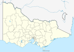
Byaduk is a town in the Shire of Southern Grampians in the Western District of Victoria , Australia . The closest location is Hamilton .
European settlement began around 1853 through Wends or Sorbs , Lutheran immigrants from Neukirch in Lusatia in Saxony . It was a Wendish community, also called Neukirch, and the first settler was Johann Rentsch. Wendisch was spoken there until Rentsch's death in 1915.
The city was called Byaduk, an Aboriginal word for "stone ax".
The post office opened on August 1, 1863.

View from Harmans Valley to Mount Napier
The Byaduk quarries, lava tubes and the volcanic cone of Mount Napier are nearby, as well as the extreme lava flow of Harmans Valley and the lava bubbles on Old Crushers Road .
Web links
Commons : Byaduk - collection of images, videos and audio files
Individual evidence
- ↑ Australian Bureau of Statistics : Byaduk ( English ) In: 2016 Census QuickStats . June 27, 2017. Retrieved April 15, 2020.
- ↑ Early BYADUK Settlers ( Memento from August 6, 2009 in the Internet Archive ): Early Byaduk Settlers , in English, accessed on October 5, 2011
- ↑ premierpostal.com : Postal History, accessed October 5, 2011
