Caernarfonshire
| Caernarfonshire | ||
|---|---|---|
|
|

|
|
| Capital | Caernarfon | |
| surface | 1,473 km² | |
| population | 121,194 (1961) | |
| Population density | 82 inhabitants / km² | |
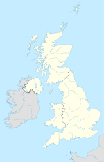
Caernarfonshire (Welsh: Sir Gaernarfon ), also Caernarvonshire or Carnarvonshire, is one of the thirteen traditional counties and a former administrative counties of Wales . The historic capital and eponymous place is the city of Caernarfon .
geography
The county is located by the sea in northwest Wales and borders Denbighshire and Merionethshire on the land side . The island of Anglesey is off Caernarfonshire. The landscape is dominated by the Snowdonia National Park with Snowdon , the highest mountain in Wales. The northwest is occupied by the Lleyn Peninsula . The river Conwy forms the eastern border . Important places besides Caernarfon are Bangor , Betws-y-Coed , Conwy , Llandudno , Porthmadog and Pwllheli .
In 1961 the county had 121,194 inhabitants on 1,473 km².
Administrative history
Caernarfonshire was an administrative county until 1974 and was then divided into the three districts of Aberconwy , Arfon and Dwyfor of the newly formed county of Gwynedd . Since the administrative reform of 1996, the area of the county has been divided between the Unitary Authorities Gwynedd and Conwy .
Individual evidence
- ↑ rororo Duden-Lexikon 1966
