Montgomeryshire
| Montgomeryshire | ||
|---|---|---|
|
|

|
|
| Capital | Montgomery | |
| surface | 2,064 km² | |
| population | 44,228 (1961) | |
| Population density | 21 people / km² | |
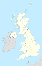
Montgomeryshire (Welsh: Sir Drefaldwyn ) is one of the thirteen traditional counties and a former administrative county of Wales . The historic capital is the city of Montgomery . Montgomeryshire has been part of Powys since 1974 .
geography
The county is bordered by Denbighshire , Shropshire , Radnorshire , Cardiganshire and Merionethshire .
The landscape is mainly mountainous. The highest point is the Cadair Berwyn (830 m). The Severn and the Dyfi are the main rivers. Notable places besides Montgomery are Llanfyllin , Machynlleth , Llanidloes , Newtown and Welshpool .
In 1961 the county had 44,228 inhabitants on 2,064 km².
history
The county is named after Roger de Montgomerie , a follower of William the Conqueror .
Montgomeryshire was an independent administrative county until 1974 and then became one of the three districts of the new County of Powys alongside Brecknockshire and Radnorshire . In 1996 all districts were dissolved and Powys became a unitary authority with county status . At the 2001 census, the area of the former Montgomeryshire district had 59,474 inhabitants.
The Montgomeryshire constituency of the British House of Commons was won by the Liberals for more than 100 years without a break .
Individual evidence
- ↑ rororo Duden-Lexikon 1966
- ↑ Population 2001 (PDF; 67 kB)
