Powys
| Powys Principal Area | |
|---|---|
| Administrative headquarters | Llandrindod Wells |
| surface | 5,196 km² |
| Residents | 132,976 (2011) |
| Welsh speakers | 69.9% |
| ISO 3166-2 | GB-POW |
| ONS code | 00NN |
| Website | www.powys.gov.uk |
Powys [ ˈpowɪs ] is the largest of the 22 Principal Areas in Wales . Powys is also a Preserved County . A Preserved County in Wales includes the jurisdiction of the ceremonial offices of Lord Lieutenant and High Sheriff . Powys is headquartered in Llandrindod Wells .
History and geography
In 1974, the counties Radnorshire , Montgomeryshire and Brecknockshire formed the new administrative county Powys in Wales . It was named after the Welsh Kingdom of Powys , which was at its greatest power in the 12th century, but was unable to achieve real rule due to its unfavorable location in the Welsh Marches along the border between England and Wales. Powys was divided into the three districts of Brecon , Montgomery and Radnor . In a further administrative reform in 1996, the three districts of Powys were abolished. Powys has since been one of Wales' 22 Principal Areas and also has Preserved County status .
In Powys, Welsh culture intermingled with English, if only because mountains and river valleys, such as the Severn Valley, stretch across the border to the west and east. Communication along the valleys resulted in relatively close ties to English market towns such as Shrewsbury and Hereford . The lower prevalence of Welsh in the eastern part of the county is due to this constellation.
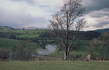
The Powys landscape is dominated by the deep valleys leading to Shrewsbury and Hereford; Typical for the "highlands" are the area of the Radnor Forest and the connecting plateaus. The landscape conditions are reflected in the livestock industry; cattle breeding dominates the green valleys and sheep breeding on the slopes of the highlands.
Remains of earlier settlement date from the Iron Age or come from Roman forts in the border area; there are also signs that point to Celtic princes and missionaries. The Celtic influence once ended at Offa's Dyke . The wall from the 8th century still exists today. The castles at Montgomery, Presteigne and Brecon date from Norman times.
The larger cities in Powys are now service centers. In the city of Newtown light industry was settled in order to promote the Powys Valley economically and to stop the rural exodus. Welshpool and Brecon remain the county's market centers. The book village Hay-on-Wye is a tourist attraction .
Attractions
See also
Web links
- Powys. In: The History Files. Kessler Associates, accessed July 19, 2010 .
- Powys High Sheriff's website
- Preserved Counties Act
Individual evidence
- ↑ Official population figures 2011 ( MS Excel ; 291 kB)
Coordinates: 52 ° 19 ′ N , 3 ° 26 ′ W


