
Caerphilly (County Borough)
| Caerphilly County Borough | |
|---|---|
  |
|
| Administrative headquarters | Hengoed |
| surface | 278 km² |
| Residents | 178,806 (2011) |
| Welsh speakers | 16.7% |
| ISO 3166-2 | GB-CAY |
| ONS code | 00PK |
| Website | www.caerphilly.gov.uk |
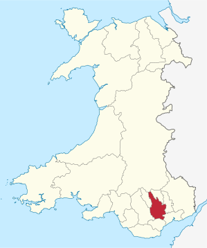
Caerphilly ( Welsh : Caerffili ) is a Principal Area with the status of a County Borough in South Wales . It is named after the city of Caerphilly .
geography
Caerphilly is bordered to the south by the Welsh capital Cardiff , to the southeast by Newport, to the east by Torfaen , to the northeast by Blaenau Gwent , to the north by Powys , to the northwest by Merthyr Tydfil and to the west by Rhondda Cynon Taf .
The county area consists of parts of the historic counties of Glamorgan and Monmouthshire. It roughly corresponds to the valley of the Rhymney River (the historic border between Glamorgan and Monmouthshire) and the middle valleys of the Sirhowy River and the Ebbw River in the South Wales valley landscape.
population
Caerphilly has 172,700 inhabitants as a county borough (as of 2009). The largest localities are the city of Caerphilly with 31,300 inhabitants, Risca, Blackwood , Bargoed, Newbridge and Rhymney.
history
Caerphilly County Borough was created in 1996 from the District Rhymney Valley of County Mid Glamorgan and Islwyn County Gwent .
politics
Caerphilly is considered a stronghold of the Labor Party ( Labor Party , Welsh Y Blaid Lafur ) that the constituencies Caerphilly, Islwyn and Merthyr Tydfil and Rhymney both at the 2005 general election and 2007 in elections to the National Assembly for Wales could win.
Local election results
| year | Labor | Plaid Cymru (Welsh National Party) | Conservative Party (Conservatives) | Liberal Democrats (Liberal Democrats) | Independent candidates |
|---|---|---|---|---|---|
| 1995 | ... | ... | ... | ... | ... |
| 1999 | 28 | 38 | 0 | 1 | 6th |
| 2004 | 41 | 26th | 0 | 0 | 6th |
| 2008 | 32 | 32 | 0 | 0 | 9 |
Web links
Individual evidence
- ↑ a b Official population figures 2011 ( MS Excel ; 291 kB)
Anglesey | Blaenau Gwent | Bridgend | Caerphilly | Cardiff | Carmarthenshire | Ceredigion | Conwy | Denbighshire | Flintshire | Gwynedd | Merthyr Tydfil | Monmouthshire | Neath Port Talbot | Newport | Pembrokeshire | Powys | Rhondda Cynon Taf | Swansea | Torfaen | Vale of Glamorgan | Wrexham
Coordinates: 51 ° 35 ′ N , 3 ° 13 ′ W