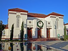
Campbell (California)
| Campbell | ||
|---|---|---|
 Downtown Campbell |
||
| Location in California | ||
|
|
||
| Basic data | ||
| Foundation : | 1952 | |
| State : | United States | |
| State : | California | |
| County : | Santa Clara County | |
| Coordinates : | 37 ° 17 ′ N , 121 ° 57 ′ W | |
| Time zone : | Pacific ( UTC − 8 / −7 ) | |
| Residents : | 39,943 (as of 2010) | |
| Population density : | 2,754.7 inhabitants per km 2 | |
| Area : | 14.8 km 2 (about 6 mi 2 ) of which 14.5 km 2 (about 6 mi 2 ) is land |
|
| Height : | 60 m | |
| Postcodes : | 95008, 95009, 95011 | |
| Area code : | +1 408 | |
| FIPS : | 06-10345 | |
| GNIS ID : | 0277483 | |
| Website : | www.ci.campbell.ca.us | |
| Mayor : | Jason Baker | |
Campbell is a city in Santa Clara County in the US state of California , with around 39,000 inhabitants (as of the 2010 census ). The urban area covers an area of 14.8 square kilometers.
Campbell is located in the southern part of the Santa Clara Valley , with Highway 17, which runs through East and Campbell and Highway 85 in the south, there is good transport links to the city. In the historic city center there is a central train station with rail connections to the surrounding cities. The city of San José is only about ten kilometers north of Campbell.
There are a few shopping malls or business complexes in the city, and most of the city's areas are residential. There are also several educational institutions in the city. Most of the apartments are single-family homes, although some areas can be found with condominiums, maisonettes, and apartments. The largest park in Campbell is Los Gatos Creek Park near Highway 17, and the second largest is John D. Morgan Park . The place was founded as a city in 1952.
sons and daughters of the town
Web links
- Official website (English)
- Campbell Community Center (English)
- Downtown Campbell (English)
- further information and pictures on CityData.com (English)
Individual evidence
- ↑ United States Census 2010 ( Memento from February 20, 2011 in the Internet Archive )

