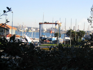
Canal de Fos at Port-de-Bouc
| Canal de Fos at Port-de-Bouc | |
|---|---|
|
Location map |
|
| location | France , Bouches-du-Rhone department |
| length | approx. 11 km |
| Built | 1820-1830 |
| Beginning | Fos-sur-Mer harbor basin |
| The End | Harbor of Port-de-Bouc |
| Ports | Fos-sur-Mer, Port-de-Bouc |
| Port-de-Bouc marina, Canal de Caronte | |
The Canal de Fos à Port-de-Bouc is a shipping canal in the south of France , which begins in the harbor basin of Fos-sur-Mer , runs along the coast of the Gulf of Fos to Port-de-Bouc and in the harbor basin in the Canal de Caronte flows.
history
In the course of its history, the course of the canal has been changed several times. The original name was Canal d'Arles à Bouc because it led from Arles via Fos-sur-Mer to Port-de-Bouc when it was built. In the 1970s, the port of Fos-sur-Mer was rebuilt, which meant that the connection to Arles was no longer possible. Therefore, the canal was divided into the Canal d'Arles à Fos and the Canal de Fos à Port-de-Bouc , which were no longer connected to each other due to a salt water barrier. It was not until the 1980s when the Canal du Rhône à Fos was built, the salt water barrier was moved further north, so that today there is an efficient connection to the Rhône via this canal . With this reconstruction, however, the Canal d'Arles à Fos became a dead end for shipping.
course
The sea channel starts in the Darse Sud harbor basin in Fos-sur-Mer and initially runs in a north-easterly direction through the industrial zone there. Then he turns to the southwest and passes the urban area of Fos-sur-Mer. In the following section, it is only protected from the sea side of the Golfe de Fos by dykes for a length of about four kilometers and finally reaches Port-de-Bouc, where it crosses the city center and flows into the Canal de Caronte in the harbor basin. This can be used to enter the Étang de Berre , where the Canal de Marseille au Rhône used to make it possible to continue to the port of Marseille . However, this stretch is impassable due to the collapse of the Tunnel du Rove . At the western end of the canal, the port of Fos has a connection to the Canal du Rhône à Fos, on which freight traffic can reach the canalized Rhône . Leisure boats must use the Canal Saint-Louis to do this .
Coordinates
- Starting point of the canal: 43 ° 25 ′ 2 ″ N , 4 ° 53 ′ 2 ″ E
- End point of the canal: 43 ° 24 ′ 9 ″ N , 4 ° 59 ′ 11 ″ E
Places on the canal
- Fos-sur-Mer
- Les Arcades
- La building mass
- Port-de-Bouc
literature
- David Edwards-May, Inland Waters of France , 5th edition, Verlag Edition Maritim, Hamburg 1997, ISBN 3-922117-61-9

