Canby (California)
| Canby | ||
|---|---|---|
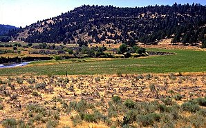
 Pit River at Canby |
||
| Location in California | ||
|
|
||
| Basic data | ||
| State : | United States | |
| State : | California | |
| County : | Modoc County | |
| Coordinates : | 41 ° 27 ′ N , 120 ° 52 ′ W | |
| Time zone : | Pacific ( UTC − 8 / −7 ) | |
| Residents : | 315 (as of 2010) | |
| Population density : | 53.6 inhabitants per km 2 | |
| Area : | 5.982 km 2 (approx. 2 mi 2 ) of which 5.875 km 2 (approx. 2 mi 2 ) is land |
|
| Height : | 1315 m | |
| Postal code : | 96015 | |
| Area code : | +1 530 | |
| FIPS : | 06-10732 | |
| GNIS ID : | 220535 | |
Canby is a census-designated place in Modoc County , Northern California at an altitude of 1,315 m . In the 2010 census , the place had 315 inhabitants. It is located in the area code 530. The zip code is 96015.
In 1874 the first post office opened in Canby. The city was named after General Edward Canby. Canby was shot at by the Modoc tribal leader Captain Jack during the Modoc War. This shooting resulted in the siege of Captain Jack's fortress .
geography
Canby is on the Pit River , a tributary of the Sacramento River . The village is about 30 km west of Alturas , the county seat of Modoc County , as the crow flies .
Individual evidence
- ↑ GNIS Detail - Canby. In: usgs.gov. geonames.usgs.gov, accessed March 23, 2017 (American English).
- ↑ Canby, California (CA 96015) profiles. In: city-data.com. www.city-data.com, accessed on March 23, 2017 (English).
