Capanna Brogoldone
| Capanna Brogoldone | ||
|---|---|---|
| location | above Lumino ; Canton Ticino , Switzerland | |
| Mountain range | Adula Alps | |
| Geographical location: | 725 200 / 124750 | |
| Altitude | 1904 m above sea level M. | |
|
|
||
| owner | Associazione Amici Capanna Brogoldone | |
| Built | 1937 | |
| Construction type | hut | |
| accommodation | 57 beds, 26 camps | |
| Winter room | 6 bearings | |
| Hut directory | SAC | |
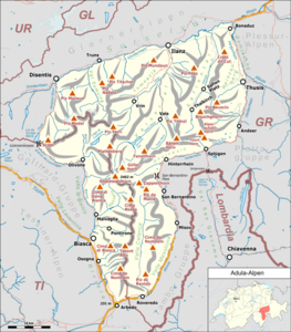
The Capanna Brogoldone is a refuge in the Adula Alps at 1904 m above sea level. M. (usually 1910 m above sea level are given). It is located in the municipality of Lumino in the Swiss canton of Ticino . According to the SOIUSA classification , the area belongs to the Lepontine Alps .
history
It was inaugurated in 1937 and renovated in 1997.
Features and information
From the hut you can enjoy a beautiful view of the Riviera , as the Ticino valley section between Biasca and Bellinzona is called.
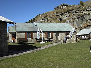
The hut consists of two buildings. In one there are the bedrooms and two common rooms. The other is the kitchen and dining room. The toilets and showers with hot water are in the building. The heating is fired with wood. The electricity for the lighting is generated by solar panels.
The hut is manned in the summer season (around mid-May to the end of October). There will then be 57 beds available, spread over six rooms and the attic. During this time, the hut guests are also catered for. In the winter season there are eight beds available without food.
Accesses
- Monti Savorù 1328 m above sea level M. - accessible from Lumino by cable car - travel time: 1 hour and 30 minutes (via steep shortcut) or 2 hours (via Sentiero delle Sculture) - difference in altitude: 576 m - degree of difficulty: T2
- Lumino 268 m above sea level M. - also accessible by bus - duration: 4 hours and 30 minutes (via a steep shortcut) or 5 hours (via Sentiero delle Sculture) - difference in altitude: 1636 m - difficulty: T2
- Giova 1004 m above sea level M. - accessible by car without snow - travel time: 2 hours and 30 minutes - altitude difference: 900 m above sea level. M. - Difficulty level: T2
- Claro 307 m above sea level M. - also accessible by bus - travel time: 5 hours - difference in altitude: 1597 m - degree of difficulty: T2
- Monti di Maruso 1205 m above sea level M. - subject to a toll and can be reached without snow - travel time: 2 hours - difference in altitude: 505 m - level of difficulty: T2
Ascents
- Pizzo di Claro 2727 m above sea level M. - Travel time: 3 hours - Difference in altitude: 800 m
- Pizzo di Molinera 2288 m above sea level M. - Travel time: 1 hour - Difference in altitude: 400 m
- Lago di Canee 2198 m above sea level M. - Travel time: 2 hours and 30 minutes - Difference in altitude: 500 m - Difficulty: T3
Transitions
- Rifugio Domàs 30 min
- Capanna Cava 7 hours
Web links
Individual evidence
- ↑ a b Height according to geo.admin.ch
- ↑ hikr.org: Lago di Cance

