Cardwell (Queensland)
| Cardwell | |||||||
|---|---|---|---|---|---|---|---|
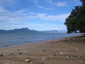
 View from Cardwells Beach to Hinchinbrook Island |
|||||||
|
|||||||
|
|||||||
|
|||||||
|
|||||||
|
|
|||||||
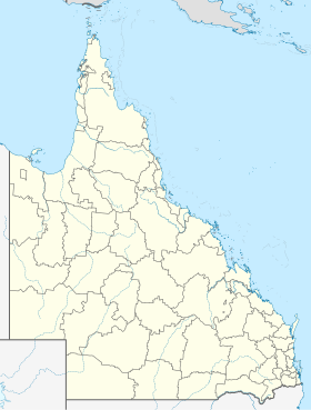
Cardwell is a place in the Australian state of Queensland between Innisfail in the north and Ingham in the south. In 2016 the population was 1251.
history
Cardwell was founded as a harbor town in January 1864 and was - then under the name Port Hinchinbrook - the first settlement north of Bowen . The place was renamed in 1864 and named after the British politician Edward Cardwell .
As an outpost of civilization, Cardwell served to connect the pastureland in the Valley of Lagoons . The place was officially named a "Port of Entry and Clearance" on May 21, 1864. In 1872 construction began on a pier on the site of the current one, which was built in 1969 at a length of 620 feet and is the third of its kind. Until 2008, Cardwell was part of the administrative area Cardwell Shire based in Tully , which was then merged with Johnstone Shire to form the Cassowary Coast region that exists today .
On the night of February 2nd to 3rd, 2011, the storm center of Cyclone Yasi hit the place directly on the sea with full force and caused such massive damage that comparisons were drawn with the destructive power of a tsunami . Cardwell had previously been largely evacuated.
Historic Buildings
Cardwell still has a number of historic buildings, the most famous of which are the Cardwell Divisional Board , which was built in 1892 , the Cardwell Bush Telegraph from 1870 and the Bellenden Homestead Farm .
climate
Temperatures reach peak values in the months of December to February with mean maxima of up to 31.5 ° C and mean minima not below 22.2 ° C. In the coldest month, July, mean maxima of 24.9 ° C and mean minima of 13.6 ° C are reached. 80 percent of the high annual rainfall averaging 2128 mm falls between December and April.
economy
The main focus of economic activities is agriculture, especially the cultivation of sugar and bananas. In 1996, over 30 percent of the workforce was employed in this sector. Throughout the Cardwell Shire tons of cane were harvested in 1995, over 1 million. Forestry and fishing are also important economic factors. Tourism also plays a major role and is only behind Cairns and Port Douglas within Far North Queensland .
Infrastructure
There are various tourist facilities such as hotels, motels, restaurants and a medical center (on Victoria Street, the main business and -verkehrsstraße Medical Center ), library, post office, bank, police station, several gas stations and an art gallery. Parallel to Victoria Street, green areas and a walkway were laid out by the sea with its sandy beach, which leads past a pier ( jetty ) to the Coral Sea Memorial Park in the north of the city and offers an impressive view of the Hinchinbrook Channel, which is the offshore island of Hinchinbrook Iceland separates from the mainland. Cardwell also has a skate park, multi-purpose hall and golf course.
On the southern edge of Cardwell the marina Port Hinchinbrook with a hotel and golf course was created. Also known is the Rainforest and Reef Center , an exhibition on the fauna and flora of the reef and the tropics.
traffic
Cardwell is on the Brisbane to Cairns railway line , on which the Spirit of Queensland train runs in both directions several times a week and also stops in Cardwell. The travel time to Brisbane is around 26:30 hours and to Cairns 3:45 to 4:45 hours.
Cardwell is on the Bruce Highway , which is part of Australia's National Highway 1 .
There is a ferry connection to the nearby Hinchinbrook Island .
Web links
Individual evidence
- ↑ a b Australian Bureau of Statistics : Cardwell ( English ) In: 2016 Census QuickStats . June 27, 2017. Retrieved April 13, 2020.
- ↑ a b History of the Cardwell Shire ( Memento of the original from February 19, 2011 in the Internet Archive ) Info: The archive link was inserted automatically and has not yet been checked. Please check the original and archive link according to the instructions and then remove this notice.
- ↑ http://www.cassowarycoast.qld.gov.au/documents/1422210/45317761/Cardwell%27s%20Jetties.pdf
- ↑ History of the former Cardwell Shire Council ( Memento of the original from April 14, 2010 in the Internet Archive ) Info: The archive link was inserted automatically and has not yet been checked. Please check the original and archive link according to the instructions and then remove this notice.
- ↑ Cardwell devastated by Cyclone Yasi Courier Mail, Brisbane - February 3, 2011
- ↑ Eva Langley. Australia , p. 162. Cologne 1990.
- ↑ Climate data from the Cardwell Marine Pde station.
- ↑ Mechtild Fülles: The country on the Great Barrier Reef , p 91. Herne 1986th
- ↑ Jan Düker: Australien - der Osten , p. 338. Ostfildern 2018.
- ↑ https://www.queenslandrailtravel.com.au/Planyourtrip/timetable
- ↑ Timetable of the Queensland North Coast Railway


