Innisfail (Queensland)
| Innisfail | |||||||
|---|---|---|---|---|---|---|---|
 Innisfail, from Coquette Point |
|||||||
|
|||||||
|
|||||||
|
|||||||
|
|||||||
|
|
|||||||
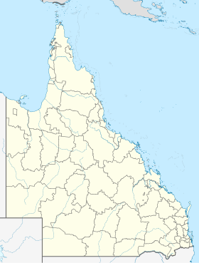
Innisfail is a town of about 8,300 people in the Australian state of Queensland on the Johnstone River. Innisfail is located 89 kilometers south of Cairns and 256 kilometers north of Townsville on the Bruce Highway . The city is the seat of the Administrative Area (LGA) Cassowary Coast Region and is known for being one of the rainiest cities in Australia. With sugar cane and banana cultivation , agriculture is the predominant branch of industry. The region received worldwide attention in March 2006 when tropical cyclone Larry - possibly the most devastating cyclone in Queensland history - devastated the area.
history
Before the settlement by Europeans, the area around Innisfail was inhabited by the Mamu , an Aboriginal tribe. Before the ship Maria sank offshore in 1872 and the survivors were able to escape to the beach near the mouth of the Johnstone River . The search party, led by Robert Johnstone , came with the intention of rescuing the stranded and punishing the Aborigines who had mistreated them. The search party later drove upriver to what is now known as the Flying Fish and Coquette Points. Johnstone praised the area in his reports of all dimensions:
“A most glorious view appeared - a noble reach of fresh water, studded with blacks with their canoes and catamarans, others on the sandy beaches; deep blue fresh water expanding to an imposing breadth. "
Johnstone named the area after himself and on his recommendation a year later, in September 1873, the explorer George Dalrymple traveled here to map the area.
A few years later, in 1879, the Irishman Thomas Henry FitzGerald came here to lay the foundation stone for the sugar industry . He was accompanied by many Kanaka , the indigenous people of New Caledonia, and a small group of Irish workers. The first house - and thus the first settlement in this area - he called Innisfallen ; a poetic name for Ireland and the name of the largest island in the Killarney Lakes .
The entire settlement was soon called Geraldton, derived from FitzGerald, but was given its original name Innisfail back in 1912 to avoid any confusion with the town of the same name in Western Australia. Cyclone Larry, which reached wind speeds of up to 290 km / h, damaged more than half of the homes in Innisfail and the surrounding area in March 2006 and injured 30 people.
location
Innisfail city center is located at the confluence of the North and South Johnstone Rivers, about 3 miles from the coast. Nearby are large areas of ancient tropical rainforests surrounded by areas of intensive agricultural use. Queensland's highest point, Mount Bartle Frere , part of the Great Dividing Range is about 15 km north of Innisfail. In the vicinity of Innisfail is one of the most important tourist attractions of Queensland, Paronella Park .
climate
Innisfail has a tropical rainy climate Af in the effective climate classification according to Köppen .
The city is constantly threatened by tropical cyclones that form in the Coral Sea during the summer months .
After the destruction by Cyclone Larry in 2006, the storm center of Cyclone Yasi also crossed the city on the night of February 2 to 3, 2011 and caused some damage. The extent of the devastation, however, was less than in the southern towns of Tully and Cardwell .
| INNISFAIL - Height: 10 m from 1908 to 2010 | ||||||||||||||||||||||||||||||||||||||||||||||||
|---|---|---|---|---|---|---|---|---|---|---|---|---|---|---|---|---|---|---|---|---|---|---|---|---|---|---|---|---|---|---|---|---|---|---|---|---|---|---|---|---|---|---|---|---|---|---|---|---|
| Climate diagram | ||||||||||||||||||||||||||||||||||||||||||||||||
| ||||||||||||||||||||||||||||||||||||||||||||||||
|
Average monthly temperatures and precipitation for INNISFAIL - Altitude: 10 m from 1908 to 2010
Source:
|
|||||||||||||||||||||||||||||||||||||||||||||||||||||||||||||||||||||||||||||||||||||||||||||||||||||||||
traffic
Highway No. 1 is a bypass in the west around Innisfail, but long-distance buses from Cairns to Townsville and Brisbane also stop in the center of the city. Also located Innisfail on the railway line from Brisbane to Cairns , on five days a week train Spirit of Queensland runs in both directions and also keeps in Innisfail.
Green spaces
In the center of town is the popular Anzac Memorial Park with a pavilion and an anti-aircraft gun from the Second World War .
sons and daughters of the town
- Steve Corica (born 1973), a football player
Web links
- University of Queensland: Queensland Places: Innisfail
- Innisfail homepage
- Detailed history of Innisfail
Individual evidence
- ↑ a b Climate statistics for Australian locations (Innisfail AWS) ( English ) Australian Government - Bureau of Meteorologie . Retrieved January 17, 2011.
- ↑ Australian Bureau of Statistics : Innisfail ( English ) In: 2016 Census QuickStats . June 27, 2017. Retrieved April 14, 2020.
- ^ Tourism and Regional Information . Retrieved January 11, 2011.
- ^ Australian Bureau of Meteorology Severe Tropical Cyclone Larry Report . Archived from the original on September 22, 2012. Info: The archive link was automatically inserted and has not yet been checked. Please check the original and archive link according to the instructions and then remove this notice. Retrieved January 11, 2011.
- ↑ a b Walkabout - Innisfail . Archived from the original on June 30, 2006. Info: The archive link was inserted automatically and has not yet been checked. Please check the original and archive link according to the instructions and then remove this notice. Retrieved January 17, 2011.
- ^ History of the Innisfail Region . Retrieved January 17, 2011.
- ↑ Veronika Pavel: Australien , Markgröningen 2011, p. 247.
- ^ Innisfail - Google Maps . Retrieved January 17, 2011.
- ↑ Mt.Bartle Frere Trail . Archived from the original on July 6, 2011. Retrieved June 2, 2006.
- ^ List of Queensland Cyclones - Windworker Roof Renovations . Retrieved June 2, 2006.
- ↑ Innisfail dodges a bullet from Cyclone Yasi Daily Telegraph, Sydney - February 3, 2011
- ↑ https://www.queenslandrailtravel.com.au/Planyourtrip/timetable


