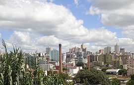
Caxias do Sul
| Caxias do Sul | ||
|---|---|---|
|
Coordinates: 29 ° 10 ′ S , 51 ° 11 ′ W Caxias do Sul on the map of Rio Grande do Sul
|
||
| Basic data | ||
| Country | Brazil | |
| State | Rio Grande do Sul | |
| City foundation | June 20, 1890 | |
| Residents | 504,069 (2018) | |
| City insignia | ||
| Detailed data | ||
| surface | 1644 km 2 | |
| Population density | 251 inhabitants / km 2 | |
| height | 817 m | |
| Post Code | 95010-95124 | |
| Time zone | UTC −3 | |
| City Presidency | Alceu Barbosa Velho | |
| Website | ||
| Center of Caxias do Sul | ||
| Santa Teresa Cathedral | ||
Caxias do Sul ( kaˈʃias du ˈsuw ) is a large city in Rio Grande do Sul , in southern Brazil .
The city has around 500,000 inhabitants and was founded by Italian immigrants on June 20, 1890. The Italian influences can still be felt today. It is the second largest city in Rio Grande do Sul.
history
The story of Caxias do Sul begins before the Italians, when the region was inhabited by the Indians. Settlement by Italian immigrants, most of whom were Italian farmers from the Veneto, began in Nova Milano in 1875. They also met people from Lombardy, Trento and other regions. Although they had received government support such as tools, provisions and seeds, everything had to be repaid. Two years later the settlement was given the name Caxias.
sons and daughters of the town
- Luís Victor Sartori (1904–1970), Roman Catholic clergyman, Bishop of Santa Maria
- Hygino Caetano Corsetti (1919-2004), politician
- Germano Rigotto (* 1949), politician
- Luíz Carlos Susin (* 1949), Roman Catholic theologian
- Tite (* 1961), soccer player and coach
- Leomar Antônio Brustolin (* 1967), Roman Catholic auxiliary bishop in Porto Alegre
- Fernando Rech (* 1974), football player
- Alex Telles (* 1992), football player


