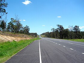
Centenary Motorway
| Centenary Motorway | |
|---|---|

|
|
| Basic data | |
| Operator: | Dept. of Transport and Main Roads |
| Start of the street: |
M5 Western Freeway Moggill Road west of Indooroopilly( Brisbane ) ( 27 ° 30 ' S , 152 ° 58' O ) |
| End of street: |
61 Centenary Highway Springfield-Greenbank Arterial Springfield Central ( QLD ) ( 27 ° 40 ′ S , 152 ° 54 ′ E ) |
| Overall length: | 43 km |
|
States : |
|
| Extension of the motorway at Ripley | |
The Centenary Motorway is a highway through the western suburbs of Brisbane in the southeast of the Australian state of Queensland . It begins west of Indooroopilly west of downtown Brisbane as a continuation of the Western Freeway (M5) and runs south to Springfield . It crosses the Ipswich Motorway (M7) at Darra and the Logan Motorway (M2) at Camira . From Springfield it runs as a two-lane main road west to Yamanto south of Ipswich .
The motorway has eight connections, the largest of which is the Ipswich Motorway (M7). It directs traffic from the west of Brisbane to the north of the city.
Designation as a motorway
Almost the entire route has been expanded to four lanes and has now also been designated as a motorway. The stretch east of Springfield, which does not yet meet the highway standard, is to be expanded over time. Since October 2006, the hexagonal Metroroad (QM5) signs have been gradually exchanged for motorway (M5) signs.
According to the South East Queensland Infrastructure Plan and Program, the M5 is to be further expanded in the future. Additional lanes are to be added to accommodate the increased traffic flow.
Exits and motorway junctions
|
Centenary Motorway |
|||
| North exits | Distance to Brisbane (km) |
Distance to Springfield (km) |
Exit to the south |
|
At the end of the Centenary Motorway, continue as the Western Freeway to Brisbane |
9 | 22nd |
Start of the Centenary Motorway further from the Western Freeway |
| Kenmore, Indooroopilly Moggill Road |
9.5 | 21.5 | no exit |
| Fig Tree Pocket Fig Tree Pocket Road |
11 | 20th | Fig Tree Pocket Fig Tree Pocket Road |
| BRISBANE RIVER | 13 | 18th | BRISBANE RIVER |
| no exit | 13.5 | 17.5 | Jindalee Sinnamon Road |
| Oxley, Jindalee Seventeen Mile Rocks Road / Sinnamon Road |
13.7 | 17.3 | no exit |
| no exit | 14th | 17th | Jindalee, Oxley Seventeen Mile Rocks Road |
| Mount Ommaney, Sinnamon Park Dandenong Road / Glen Ross Road |
15th | 16 | Sinnamon Park, Mount Ommaney Glen Ross Road / Dandenong Road |
| Jamboree Heights, Darra Sumners Road |
16 | 15th | Darra, Jamboree Heights Sumners Road |
| IPSWICH RAILWAY LINE | 16.5 | 14.5 | IPSWICH RAILWAY LINE |
|
Ipswich Motorway to Ipswich (26 km), Sydney (972 km), Melbourne (1686 km) and Darwin (3417 km) |
17th | 14th |
Ipswich Motorway to Rocklea (9 km) and Woolloongabba (15 km) |
| no exit | 18th | 13 | Kelliher Road / Freeman Road |
| Forest Lake, Richlands Garden Road |
18.5 | 12.5 | Richlands, Forest Lake Garden Road |
| Wacol, Woodridge Progress Road |
19th | 12 | no exit |
| Logan Central, Gold Coast , Sunshine Coast Logan Motorway |
22nd | 9 | Logan Central, Gold Coast Logan Motorway |
|
Ipswich , Sydney , Melbourne , Darwin Logan Motorway |
|||
| Springfield, Springfield Lakes Springfield Parkway / Springfield Lakes Boulevard |
29 | 2 | Springfield Lakes, Springfield Springfield Parkway / Springfield Lakes Boulevard |
| no exit | 30th | 1 | Greenbank, Springfield, Springfield Central Springfield-Greenbank Arterial |
| Beginning of the M5 Centenary Motorway | 31 | - | End of Centenary Motorway M5 |
|
Augusta Parkway to Redbank Plains (7 miles) and Ipswich (13 miles) Main Street Sinnathamby Boulevard |
|||
literature
Steve Parish: Australian Touring Atlas . Steve Parish Publishing. Archerfield QLD 2007. ISBN 978-1-74193-232-4 . P. 3 + 6 + 7
