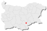
Charmanli
| Charmanli (Харманли) | |||
|
|||
| Basic data | |||
|---|---|---|---|
| State : |
|
||
| Oblast : | Haskovo | ||
| Residents : | 20,413 (December 31, 2016) | ||
| Area : | 51.5 km² | ||
| Population density | 396.4 inhabitants / km² | ||
| Coordinates : | 41 ° 56 ' N , 25 ° 54' E | ||
| Height : | 60 m | ||
| Postal code : | 6450 | ||
| Telephone code : | (+359) 0373 | ||
| License plate : | X | ||
| administration | |||
| Mayor : | Mikhail Liskov | ||
| Website : | Община Харманли - официален сайт | ||

Charmanli [ ˈxarmɐnli ] ( Bulgarian Харманли ) is a city in southern Bulgaria , in Haskovo Oblast , 33 km east of the city of Haskovo . Charmanli is the third largest city in Haskovo Oblast after Haskovo and Dimitrovgrad . Charmanli is the administrative center of the Charmanli municipality of the same name.
geography
The city is located at the confluence of the Charmanli and Maritsa rivers . The Istanbul - Sofia road , which is an important transcontinental transit route, runs through the city. The largest camp for refugees in Bulgaria is located on the city limits.
religion
There is a small Muslim minority in the city. The Roma in the city are roughly equally Christian and Muslim. There are two large churches in the city - Sweti Atanasij (bulg. Свети Атанасий, built in 1835) and Sweti Iwan Rilski (bulg. Свети Иван Рилски; for the person see: Iwan Rilski ).
economy
The main industries in the region are agriculture , furniture production, meat processing and edible oil production . There are two wineries in town that produce high quality wine.
Attractions
There is a caravanserai in the city that was a resting place for travelers to Istanbul. Today only one wall remains with an inscription that testifies to the 500-year history of the city.
Lookout point
On the road from Haskowo to Charmanli, just before Haskowo, the road makes a bend above the western half of the city. The road runs down a small slope there - the town is hidden in the valley between the hills in the south and south-west and the view along the Mariza valley is unobstructed to the north and east. Shortly after entering the city, you cross the Charmanli River, which crosses a beautiful gorge on its upper reaches.
Garbawi Bridge
The former Garbawi Bridge (Bulgarian Гърбав мост), now located behind the District Court and Museum building, used to connect the two sides of the Charmanli River. This paved stone bridge, with a Turkish inscription, was a masterpiece of Ottoman architecture. Because of a diversion of the river bed, no more water flows under the bridge today. Originally, the construction of a lake with rowing boats was planned for this river diversion, over which the bridge should lead.
Trifon mountain peak
The Trifon summit (after the Holy Tryphon ) near the village of Ostar Kamak (Bulgarian Остър камък, in German: Pointed Stone) is a beautiful vantage point. Next to it was a dolmen , which was painted brown in 2007 by strangers. Every year on February 1st, Trifon Day (the patron saint of winemakers), a big festival is held on the mountain.
Belonoga source
If you leave Charmanli in an easterly direction, you come to the source of the Belonoga. The spring was developed as a drinking fountain, with a stone tablet with the poem of the same name (The source of the Belonoga - bulg. "Изворът на Белоногата", 1873, a very well-known poem in Bulgaria) by Petko Slavykov (Bulgarian Петко Славейкоро1895), 1827 and a statue.
Others
- Chitalishte Druzhba (Bulgarian Дружба) with attached theater,
- Historical Museum - near the Garbawibrücke historical monument
Individual evidence
- ↑ Beaten up in sleep . In: jungle.world . ( jungle.world [accessed May 29, 2018]).


