Clearwater River (Blackfoot River)
| Clearwater River | ||
|
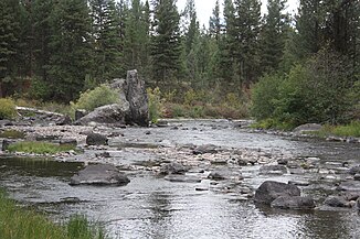
Clearwater River at its confluence with the Blackfoot River |
||
| Data | ||
| Water code | US : 800475 | |
| location | Montana (USA) | |
| River system | Columbia River | |
| Drain over | Blackfoot River → Clark Fork → Pend Oreille River → Columbia River → Pacific Ocean | |
| origin | Clearwater Lake 47 ° 23 '25 " N , 113 ° 33' 43" W. |
|
| Source height | 1461 m | |
| muzzle |
Blackfoot River Coordinates: 46 ° 57 '53 " N , 113 ° 22' 44" W 46 ° 57 '53 " N , 113 ° 22' 44" W. |
|
| Mouth height | 1143 m | |
| Height difference | 318 m | |
| Bottom slope | approx. 4.9 ‰ | |
| length | approx. 65 km | |
| Catchment area | 1013 km² | |
| Discharge A Eo : 896 km² Location: 7.7 km above the mouth |
MQ 1975/1992 Mq 1975/1992 |
7.9 m³ / s 8.8 l / (s km²) |
| Right tributaries | Owl Creek | |
| Flowing lakes | Rainy Lake, Lake Alva, Lake Inez, Seeley Lake, Salmon Lake | |
| Communities | Seeley Lake | |
The Clearwater River is a 40 miles long right tributary of the Blackfoot River in the US state of Montana .
River course
The Clearwater River has its origin in the 1461 m high Clearwater Lake in the Rocky Mountains . To the east of the lake rises the Swan Range with Ptarmigan Mountain ( 2631 m ). The river flows mainly in a south-south-east direction through the mountains. The Montana Highway 83 follows the course of the river. The Clearwater River flows through several smaller lakes: Rainy Lake, Lake Alva, Lake Inez, Seeley Lake, Salmon Lake. It flows west past the village of Seeley Lake . Salmon Lake State Park is located on the east bank of Salmon Lake . The catchment area of the Clearwater River, located mostly within the Lolo National Forest . The Clearwater River eventually flows into the Blackfoot River.
Hydrology
The catchment area of the Clearwater River covers 1013 km². The mean discharge is 7.7 km above the estuary 7.9 m³ / s. The highest monthly discharge occurs in May with an average of 28.6 m³ / s.
Web links
Individual evidence
- ↑ Clearwater Lake in the United States Geological Survey's Geographic Names Information System
- ^ Clearwater River in the Geographic Names Information System of the United States Geological Survey
- ↑ USGS 12339500 Clearwater River at Clearwater MT
- ↑ a b USGS 12339450 Clearwater River near Clearwater MT
