Contuboel
| Contuboel | ||
|---|---|---|
|
|
||
| Coordinates | 12 ° 22 ′ N , 14 ° 34 ′ W | |
| Basic data | ||
| Country | Guinea-Bissau | |
| Leste | ||
| region | Bafatá | |
| ISO 3166-2 | GW-BA | |
| surface | 1,550.4 km² | |
| Residents | 44,048 (2009) | |
| density | 28.4 Ew. / km² | |
|
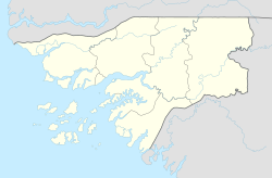
Location of the Contuboel sector in the Bafatá administrative region
|
||
Contuboel is a small town in northeast Guinea-Bissau with 4115 inhabitants (as of 2009). It is the seat of the sector of the same name with an area of 1550 km² and 44,048 inhabitants (as of 2009), mainly Fulbe and Mandinka .
The landscape in the Contuboel sector is shaped by savannah .
Agriculture and livestock (cattle and goats) are the essential foundations of the local economy.
Web links
Commons : Contuboel - collection of images, videos and audio files
- Impressions from the center of Contuboels , private video clip on YouTube
Individual evidence
- ↑ a b Inhabitants by region, sector and town by gender, 2009 census (p. 81), PDF retrieval from the National Statistics Office INE of December 15, 2017
- ↑ Annual Statistical Report Guinea-Bissau 2015 (p. 10), PDF available from the National Statistics Office INE on December 16, 2017
- ↑ Joana Petrolho, Marta Rosa: À Descoberta da Guiné-Bissau . , Afectos com Letras / EU , Pombal 2015, ISBN 978-989-20-6252-5 , p. 73

