Xitole
| Xitole | ||
|---|---|---|
|
|
||
| Coordinates | 11 ° 44 ′ N , 14 ° 49 ′ W | |
| Basic data | ||
| Country | Guinea-Bissau | |
| Leste | ||
| region | Bafatá | |
| ISO 3166-2 | GW-BA | |
| surface | 1,339.2 km² | |
| Residents | 16,928 (2009) | |
| density | 12.6 Ew. / km² | |
|
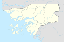
Location of the Xitole sector (light blue, bottom) in the Bafatá administrative region
|
||
Xitole is a village in southern Guinea-Bissau with 447 inhabitants (as of 2009).
The place is the seat of the administrative sector of the same name with an area of 1339.2 km² and 16,928 inhabitants (status 2009), mainly Fulbe and Mandinka .
The Xitole sector is very rural and has no major capital. The eponymous village was a military camp of the Portuguese armed forces during the colonial war in Portuguese Guinea until independence in 1974 and is now an insignificant village.
Attractions
The most important sight in Xitole are the ruins of the Ponte Marechal Carmona bridge . The remains of the bridge, which was built in colonial times and named after the Portuguese general and president Óscar Carmona , offers a unique vantage point over the wide landscape around the Rio Corubal .
In the original main town of Xitole, only ruins of the Portuguese military installations can be seen, such as the airfield and helipad, some preserved buildings and defenses.
The former Saltinho military camp is now a pousada . The simple hotel complex, mainly visited by Portuguese war veterans and hunting and nature tourists, offers a wide view of the local rapids and small waterfalls on the Rio Corubal . A Portuguese bridge with concrete arches crosses the river where the ruins of an earlier stone bridge used by the Portuguese can be seen. Women from the surrounding villages often wash laundry, dishes and their children here. The view of the bridge, the river leaping over rocks and the washerwomen are frequent photo opportunities for tourists and photographers.
structure
The Xitole sector includes 131 localities, almost exclusively rural villages ( tabancas ), including:
- Cambessé (680 inhabitants)
- Cancode (a Balanta village with 149 and a Mandinka village with 421 inhabitants)
- Dulo Sangele (497 inhabitants)
- Madina Maudo Buk (596 inhabitants)
- Saltinho (78 inhabitants)
- Tchumael (495 inhabitants)
- Xitole (447 inhabitants)

Sons and daughters of the place
- Welket Bungué (* 1988), Guinea-Bissau-Portuguese actor and filmmaker
Web links
- Impressions from Xitole , private video of former Portuguese soldiers visiting Xitole 2000, video on YouTube
Individual evidence
- ↑ a b Inhabitants by region, sector and town by gender, 2009 census (p. 78), PDF access from the National Statistics Office INE of December 15, 2017
- ↑ Annual Statistical Report Guinea-Bissau 2015 (p. 10), PDF available from the National Statistics Office INE on December 16, 2017
- ↑ a b Joana Petrolho, Marta Rosa: À Descoberta da Guiné-Bissau . , Afectos com Letras / EU , Pombal 2015, ISBN 978-989-20-6252-5 , p. 73
- ↑ a b Collection of photos from 1970-72 and from 2001 with explanations on a website of the Universidade Nova de Lisboa (Portuguese), accessed on January 20, 2018
- ↑ Joana Petrolho, Marta Rosa: À Descoberta da Guiné-Bissau. , Afectos com Letras / EU , Pombal 2015, ISBN 978-989-20-6252-5 , p. 77
- ↑ Guiné-Bissau 1974/2015 , catalog for the 2017 exhibition by the photographer Alfredo Cunha in the municipal Galeria do Paço da Cultura in Guarda ( ISBN 978-989-8676-13-9 )
- ^ Alfredo Cunha, Luís Pedro Nunes: Toda a Esperança do Mundo. , Porto Editora , Porto 2015 ( ISBN 978-972-0-04780-9 ), pp. 130ff

