Crieulon
|
Crieulon Ruisseau de Crieulon |
||
|
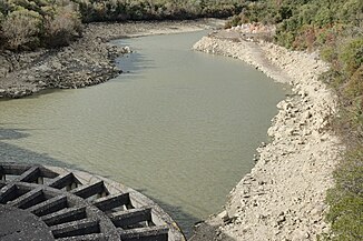
The river in the Rouvière retention basin |
||
| Data | ||
| Water code | FR : Y3430500 | |
| location | France , Occitania region | |
| River system | Vidourle | |
| Drain over | Vidourle → Mediterranean | |
| source | in the municipality of Saint-Félix-de-Pallières, 44 ° 1 ′ 3 ″ N , 3 ° 57 ′ 8 ″ E |
|
| Source height | approx. 287 m | |
| muzzle | in the municipality of Orthoux-Sérignac-Quilhan in the Vidourle coordinates: 43 ° 52 ′ 50 ″ N , 4 ° 2 ′ 36 ″ E, 43 ° 52 ′ 50 ″ N , 4 ° 2 ′ 36 ″ E |
|
| Mouth height | approx. 51 m | |
| Height difference | approx. 236 m | |
| Bottom slope | approx. 11 ‰ | |
| length | approx. 21 km | |
| Reservoirs flowed through | Barrage de la Rouvière | |
The Crieulon is a river in France that runs in the Gard department in the Occitanie region . It rises near the hamlet of Euzière in the municipality of Saint-Félix-de-Pallières , generally drains in a south-easterly direction and flows into the Vidourle as a left tributary after about 21 kilometers in the municipality of Orthoux-Sérignac-Quilhan .
Hydrology
The flow of the river is subject to strong seasonal fluctuations. While only small amounts of water are recorded in the summer months, in the rest of the time, especially after heavy rainfall, an acute risk of flooding can be observed in the entire catchment area of the Vidourle. For this reason, a dam with retention basin (Barrage de la Rouvière) was built on the lower reaches of the Crieulon and put into operation in 1971.
Places on the river
(Order in flow direction)
- Euzière , commune of Saint-Félix-de-Pallières
- Baruel , commune of Saint-Félix-de-Pallières
- Les Costes , municipality of Durfort-et-Saint-Martin-de-Sossenac
- Saint-Jean-de-Crieulon
- Logrian-Florian
- Mas du Sire , Quissac municipality
- Orthoux , Orthoux-Sérignac-Quilhan municipality
