Cuttyhunk
| Cuttyhunk Island | ||
|---|---|---|
| Waters | Atlantic Ocean | |
| Archipelago | Elizabeth Islands | |
| Geographical location | 41 ° 25 ′ N , 70 ° 56 ′ W | |
|
|
||
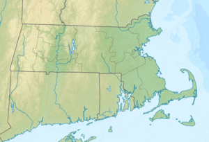
Cuttyhunk , in English: Cuttyhunk Island , is the outermost island in the southwest of the Elizabeth Islands in Dukes County in the US state of Massachusetts .
geography
The island is the fourth largest of the 14 Elizabeth Islands with an area of 2,347 square kilometers. It is located between Buzzards Bay to the north and Vineyard Sound to the south. It is separated from the neighboring island of Nashawena Island by the Canapitsit Channel . In the northeast, the two small peninsulas Canapitsit and Copicut Neck form a large natural harbor. The highest point on the island is on Lookout Hill, 47 meters above sea level.
The village of Cuttyhunk has 52 inhabitants and belongs to the town of Gosnold .
Around half of the island is a nature reserve with a variety of bird species, especially the yellow-footed plover , the American little tern and the Massachusetts oystercatcher .
history
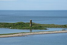
The original inhabitants of the Wampanoag people called the island Poocuohhunkkunnah . In 1602 the English explorer Bartholomew Gosnold came to this island with the ship The Concord after landings at Kennebunkport in Maine , Cape Cod and Martha's Vineyard , which he gave the new name Cuttyhunk. He and his crew built a small fort before the expedition returned to England. At the West End Pond there is a monument to the discoverer of the island Bartholomew Gosnold.
In addition to agriculture and fishing, the residents found another activity with the pilotage for arriving ships in the difficult waters with numerous reefs around the archipelago. In the early 20th century, Cuttyhunk pilots often escorted more than 10 ships a day through Buzzards Bay to the port city of New Bedford . Cuttyhunk is known for fishing for striped bass .
In 1847, the Massachusetts Humane Society set up rescue stations on the Elizabeth Islands, with whose materials the islanders could rush to the aid of ships in need. On the hill is a United States Coast Guard bunker from 1941, which was used as a submarine scouting post during World War II . The Cuttyhunk lighthouse in the west of the island had existed since 1823 and was decommissioned in 1947 and replaced by a lattice mast beacon.
Ship accidents
Ships have sunk again and again on the southern tip of the Elizabeth Islands near Cuttyhunk, for example:
- on February 24, 1893 the ship Aquatic
- on November 27, 1898 the passenger and cargo steamer Fairfax (in the devastating storm Portland Gale , which killed over 150 ships off the coast of New England)
- on August 26, 1924 the whaler Wanderer
In August 1992 the Cunard passenger ship Queen Elizabeth 2 ran into a reef southeast of Cuttyhunk that had not yet been recorded on the nautical charts and suffered severe damage to the hull.
literature
- Louise T. Haskell: The Story of Cuttyhunk. New Bedford 1953.


