New Bedford, Massachusetts
| New Bedford | ||
|---|---|---|
| Nickname : The Whaling City | ||
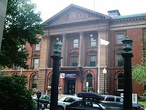
 City Hall of New Bedford |
||
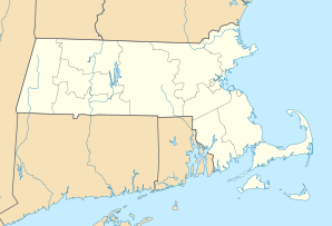
| Location in Massachusetts | ||
|
|
||
| Basic data | ||
| Foundation : | 1640 | |
| State : | United States | |
| State : | Massachusetts | |
| County : | Bristol County | |
| Coordinates : | 41 ° 38 ′ N , 70 ° 56 ′ W | |
| Time zone : | Eastern ( UTC − 5 / −4 ) | |
| Residents : | 95,072 (as of 2010) | |
| Population density : | 1,824.8 inhabitants per km 2 | |
| Area : | 62.2 km 2 (approx. 24 mi 2 ) of which 52.1 km 2 (approx. 20 mi 2 ) is land |
|
| Height : | 15 m | |
| Postcodes : | 02740, 02744-02746 | |
| Area code : | +1 508, 774 | |
| FIPS : | 25-45000 | |
| GNIS ID : | 0613714 | |
| Website : | www.newbedford-ma.gov | |
| Mayor : | Scott W. Lang | |
New Bedford is a port city in Bristol County , Massachusetts , United States . The city is 76 km south of Boston . Its population was 95,072 in 2010.
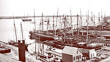
In the 19th century the city was an important center of whaling and timber shipbuilding . The New Bedford Historic District , a National Historic Landmark , is a reminder of this . Today the city is home to a famous whaling museum (The New Bedford Whaling Museum). Herman Melville's Moby-Dick is set in part in New Bedford. The 1983 mass rape of Cheryl Araujo in a New Bedford bar attracted national media attention and became known as the New Bedford Bar Rape .
history
Before the 17th century, the only inhabitants living along the Acushnet River were the Wampanoag (Indian tribe), native to the entire southeastern area of Massachusetts and Rhode Island . Their number is put at 12,000 people. The British explorer Bartholomew Gosnold landed on Cuttyhunk Island on May 15, 1602. From there he explored Cape Cod and the surrounding areas, including what is now New Bedford. The first settlement of the New Bedford area by Europeans did not take place until 1652. Settlers of the Plymouth Colony acquired land from the sachem (chief) Massasoit of the Wampanoag. This led to misunderstandings. Since the Wampanoag have no ownership , they thought they had only sold the rights of use to the settlers but not permanently surrendered their property rights. The settlers built the settlement of Old Dartmouth, along with other fishing and farming villages, which included not only present-day Dartmouth, but also present-day New Bedford, Acushnet, Fairhaven and Westport. An area of Old Dartmouth near the west bank of the Acushnet River called Bedford Village was bought by a prominent and wealthy middle-class family called Russel in 1787 and renamed New Bedford as a separate property. There were shipyards that built sailing ships, etc. a. the schooner Caroline and the whaling ship Charles W. Morgan . The late 18th century was a period of growth. New Bedford's first newspaper, The Medley , also known as the New Bedford Marine Journal , was founded in 1792. In the same year the city got its first post office. Immigrants from the whaling island of Nantucket started the successful whaling industry in New Bedford. The city of Fairhaven separated from New Bedford in 1812 and became independent. In 1847 New Bedford was declared a city. The first mayor was named Abraham Hathaway Howland.
At the same time, New Bedford began to replace the island of Nantucket as the largest and leading port of the whaling industry, which is described at the beginning of the novel Moby-Dick by Herman Melville. The whaling was in that century the most successful and most formative of business of the city. Today you can see the history of whaling in the historically preserved area of the city. In memory of that time, a bay in New Bedford Inlet was named in Antarctica .
In the mid-1840s, the United States' first petroleum oil refinery was built on neighboring Fish Island. Shortly before serviced crude oil in Pennsylvania was shipped to the experienced in the Walölverarbeitung New Bedford, where, as before, the whale was made into lamps and other oils. Industrial production of gas from coal ( coal gasification ) began on the island . However, there was a huge explosion that destroyed a building.
New Bedford's economy received stability from the textile industry . The University of Massachusetts Dartmouth created the New Bedford Textile School, which helped the textile industry in the years 1895-1899 to a great boom. However, it shrank during the Great Depression and ended entirely in the 1940s. At the wedding, 30,000 people were employed in 32 cotton mills. The tool industry emerged there in the 1970s.
The fishing industry , which had been successful since New Bedford's inception, began to decline in the mid-1990s when restrictions imposed by overfishing of the seas came into effect.
geography
New Bedford is a coastal town and seaport, adjacent to the parish of Dartmouth to the west, Fairhaven to the north, Acushnet and Fairhaven to the east, and Buzzards Bay to the south . From New Bedford's northern border with Freetown to the coast of Buzzards Bay at Clark's Point, the distance is approximately 14 miles. The east-west diameter is approx. 3.2 km. The highest point in the city is an unnamed hill traversed by Interstate 195 and Hathaway Road to the west of Old Town, more than 55 meters above sea level.
The port of New Bedford, which it shares with Fairhaven, is actually the confluence of the Acushnet River , which flows into Buzzards Bay east of the Clark's Point headland, the southernmost point of the city. To the west, on the other side of Clarks Point, the elongated Clarkes Cove extends 2.5 kilometers inland.
Just below the uninhabited island of Palmer's Island, which borders the harbor to the south, there is a storm surge barrier over three kilometers long, which is supposed to protect the harbor and the fishing fleet anchored there. In addition to Palmer's Island, the islands Fish Island and Pope's Island belong to the city. The supports of the Bedford-Fairhaven Bridge stand on the latter. The middle part, a bascule bridge , connects the two islands, but at the same time allows the passage of ships and boats to the upper part of the port.
The city's largest park, Brooklawn Park, is at the north end, and the next largest, Fort Taber Park (also called Fort Rodman because there were two forts at the time), on Clark's Point. On the city limits of Dartmouth is Buttonwood Park, which has a lagoon and a zoo . In the northwest of the city is the nature reserve of the Acushnet Cedar Swamp (cedar swamp), which extends to the area of Dartmouth.
sons and daughters of the town
- Clifford Ashley (1881–1947), seaman, painter, and non-fiction writer
- Peirce H. Brereton (1894–1963), politician
- Jonathan Bourne (1855-1940), politician
- William M. Butler (1861–1937), politician
- Albert Crossley (1903–1981), cyclist
- Mark Dion (* 1961), painter and object artist
- Frederick Douglass (1817 or 1818–1895), abolitionist and writer
- Henry Grinnell (1799–1874), shipowner and merchant
- David Maslanka (1943–2017), composer and music teacher
- Miriam Moffitt (1884–1954), pianist and band leader
- George S. Morison (1842–1903), civil engineer
- Andrew Rubin (1946-2015), actor
- Melanie S. Sanford (* 1975), chemist
- Quinn Sullivan (* 1999), blues musician
- Dawn Clifton Tripp (born 1969), writer (born in Westport Point)
- John W. Tukey (1915-2000), statistician
- Samuel Wagstaff (* 1945), mathematician
also:
- A Wilhelm Scream , punk rock band
Town twinning
-
 Utqiaġvik , Alaska
-

 Funchal , Madeira , Portugal
-

 Horta , Azores , Portugal
-
 Mindelo , Cape Verde
-
 Tosashimizu , Japan (since 1987)
 -
 Figueira da Foz , Portugal


