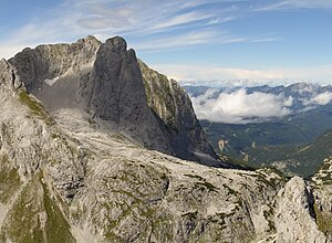
Thumbnail (Mountain)
| Tom Thumb | ||
|---|---|---|
|
Däumling seen from the south (Steiglkogel) |
||
| height | 2322 m above sea level A. | |
| location | Upper Austria , Austria | |
| Mountains | Gosaukamm , Dachstein Mountains | |
| Coordinates | 47 ° 30 '7 " N , 13 ° 31' 3" E | |
|
|
||
| rock | Summit structure made of Dachstein reef limestone ; Base made of rocks from the main dolomite | |
| Age of the rock | Upper Triassic | |
| First ascent | Paul Preuss and Georg von der Saar | |
| Normal way | Normal route over the north face and south edge | |
The Däumling is a mountain with a height of 2322 m above sea level. A. and lies in the Gosau ridge of the Dachstein massif . The summit is in the municipality of Gosau . It is a rock pillar east of the Niedere Großwandeck .
It is the most difficult summit to climb in the Dachstein massif. The summit was first climbed on September 18, 1913 by Paul Preuss and Georg von der Saar. A little later Paul Preuss crashed on the nearby Mandlkogel .
The Hofpürglhütte serves as the nearby starting point for the ascent .
Web links
Commons : Tom Thumb - collection of images, videos and audio files
Individual evidence
- ^ Christian Leidinger: Geology of the Dachstein area ( Memento from August 18, 2010 in the Internet Archive ); Retrieved February 3, 2011.

