
Artibonite department
| Basic data | |
|---|---|
| Main town : | Gonaives |
| Area : 4887 km² | |
| Residents : | 1,727,524 (2015) |
| Population density : | 353 inhabitants per km² |
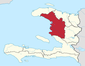
| map | |
  |
|
Artibonite is one of the ten departments in Haiti . It is named after the Artibonite River , which flows into the Gulf of Gonâve . It covers an area of 4887 km² and has around 1,728,000 inhabitants (as of 2015). Besides the capital Gonaïves , Saint-Marc is the most important city in the Artibonite department.
history
In early 2004, armed opponents of President Jean-Bertrand Aristide united to form the Front pour la Reconstruction Nationale (FRN). Their uprising began in the Artibonite department and led to the overthrow of the president on February 29, 2004.
economy
Much of the Haitian rice is grown in Artibonite .
Arrondissements
The department is divided into five districts (arrondissemente) :
Cities and villages
- Anse Rouge
- Disarm
- Desdunes
- Dessalines
- Ennery
- Gonaives
- Grande Saline
- Gros-Morne
- La Chapelle
- jam
- Petite-Riviere-de-L'Artibonite
- Saint Michel de l'Attalaye
- Saint-Marc
- Terre-Neuve
- Verrettes
Footnotes
- ↑ Population totale par sexe et population de 18 ans et plus, ménages et densités, estimées en 2015 . Institut Haïtien de Statistique et d'Informatique, Port-au-Prince 2015, p. 77, accessed on November 22, 2018.
- ^ Institut Haïtien de Statistique et d'Informatique: Population totale par sexe et population de 18 ans et plus, ménages et densités, estimées en 2015 . Port-au-Prince 2015, table Population totale par sexe et population de 18 ans et plus, estimées en 2015, au niveau des différentes unités géographiques (Arrondissements, Communes, Sections Communales) , p. 21, accessed on November 22, 2018.
Artibonite | Center | Grand'Anse | Trinkets | North | North-East | Nord-Ouest | Ouest | Sud | South-Est