Dikilitaş (Besni)
| Dikilitaş | ||||
|
||||
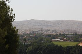
 Dikilitaş from the north, Sesönk in the background |
||||
| Basic data | ||||
|---|---|---|---|---|
| Province (il) : | Adıyaman | |||
| District ( ilçe ) : | Besni | |||
| Coordinates : | 37 ° 30 ' N , 38 ° 4' E | |||
| Height : | 501 m | |||
| Residents : | 545 (2012) | |||
| Telephone code : | (+90) 416 | |||
| Postal code : | 02300 | |||
| License plate : | 02 | |||
| Structure and administration (as of 2016) | ||||
| Muhtar : | Ömer Çolak | |||
Dikilitaş is a village in the district of Besni the Turkish province of Adiyaman . The place is about 30 kilometers southeast of the county seat and 40 kilometers southwest of the provincial capital Adıyaman . It is connected to Besni by a country road via Üçgöz . The village is located on a small tributary of the Değirm Çayı . This flows into the Göksu eight kilometers east of Dikilitaş , which in turn flows into the Euphrates, which flows six kilometers south of Dikilitaş .
Between the place and the Euphrates in the south lies an impassable mountain landscape, locally called Kızıldağ , on the crest of which the ancient burial shrine Sesönk lies.
Individual evidence

