Divatte
| Divatte | ||
|
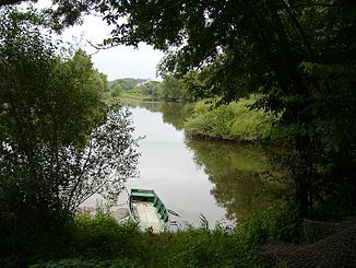
The confluence with the Loire |
||
| Data | ||
| Water code | FR : M6214000 | |
| location | France , Pays de la Loire region | |
| River system | Loire | |
| Drain over | Loire → Atlantic Ocean | |
| source | in the municipal area of Montrevault-sur-Èvre 47 ° 16 ′ 10 ″ N , 1 ° 8 ′ 3 ″ W |
|
| Source height | approx. 98 m | |
| muzzle | below La Varenne in the Loire Coordinates: 47 ° 18 '7 " N , 1 ° 20' 43" W 47 ° 18 '7 " N , 1 ° 20' 43" W. |
|
| Mouth height | approx. 4 m | |
| Height difference | approx. 94 m | |
| Bottom slope | approx. 2.9 ‰ | |
| length | 32 km | |
The Divatte is a river in the French region of Pays de la Loire .
course
It rises in the municipality of Montrevault-sur-Èvre and initially drains in a south-westerly direction. In the area of La Boissière-du-Doré it swings to the north-west, forms the border between the departments Maine-et-Loire and Loire-Atlantique in its lower reaches and flows after a total of 32 kilometers below La Varenne as a left tributary into a tributary of the Loire .
Places on the river
- Saint-Christophe-la-Couperie
- La Boissière-du-Doré
- La Remaudière
- Barbechat , municipality of Divatte-sur-Loire
- La Varenne
Web links
Commons : Divatte - collection of pictures, videos and audio files
