Double sea notch
| Doppelseescharte (Seejöchli) | |||
|---|---|---|---|
| Compass direction | south | North | |
| Pass height | 2786 m above sea level A. | ||
| Talung | Paznaun | Stanzertal | |
| Watershed | Moosbach → Rosanna → Sanna (→ Inn) | Madleinbach → Trisanna → Sanna | |
| Valley locations | Ischgl | St. Anton am Arlberg | |
| Mountains | Verwallgruppe : Kuchenspitzgruppe / Kartellgruppe | ||
| profile | |||
| Ø pitch | % (1410 m /? Km) | % (1502 m /? Km) | |
| Map (Tyrol) | |||
|
|
|||
| Coordinates | 47 ° 2 '39 " N , 10 ° 15' 43" E | ||
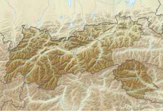
The Doppelseescharte (older also Seejöchli ) is a 2786 m above sea level. A. high pass in Verwall in Tyrol . It is located between St. Anton am Arlberg in the Stanzer Valley and Ischgl in Paznaun .
Location and landscape
The yoke lies between the Rauteturm ( 2825 m above sea level ) and Rautekopf ( 2849 m above sea level ) to the west and the Seeköpf (south about 3053 m above sea level , northern 3061 m above sea level ) east and crosses thus the main ridge of the Verwall.
The Madleinalpe extends south over Ischgl ( 1376 m above sea level ) . Here lies directly below at 2437 m above sea level. A. the Madleinsee , which then drains over the Madleinbach to Trisanna . To the north extends the rear cartel , the western high valley of the Moosbach . Here it leads over the cartel store to 2020 m above sea level. A. to St. Anton (bridge of the Rosanna 1300 m above sea level , the place 1284 m above sea level ).
It got its name from the two lakes, on older maps it can also be found as Seejöchli .
To the north of the high valley lies a rock glacier , a debris-covered glacier remnant of a smaller glacier that existed in the 1970s.
On the Doppelseescharte, the Verwall group is divided into the Kuchenspitz group around the Kuchenspitze and Küchlspitze to the west and the cartel group around the Saumspitze and Fatlarspitze to the northeast.
Development and ways
You cross the Doppelseescharte when you climb from Ischgl to the Darmstädter Hütte , which is 2384 m above sea level. A. is above the Kartellsee. The path leads from the village over the Madleinalpe - Madleinsee to the Joch, and on the other side the Advokatenweg , a section of the Verwall Höhenwege, westwards.
The hiking trail does not go over the impassable deepest point in the ridge (approx. 2770 m above sea level ), but about 100 meters east of it over the shoulder. In the flowing rock glacier of the north ascent, there are no path markings, there are some cairns.
Individual evidence
- ↑ 2788 m above sea level A. at the official coordinate: TIRIS , data from the laser scan / digital terrain model
- ↑ The official location is a few meters north of the municipality boundary, therefore St. Anton is specified as a municipality.
- ↑ The name can already be found in Eduard Amthor : Guide through Tyrol ; Information from Otto von Bülow: From the Verwall Group. In: Mitteilungen des Deutschen und Österreichischen Alpenverein No. 12 (Volume 13), 1887, p. 141 (whole article 139–141, eReader online , Austrian Literature Online / uibk.ac.at) - there the contemporary lack of clarity regarding the Schneidjöchli (on the other side of the Seeköpfe) discussed: Hämmerle mentioned (Mitteilungen 1879, p. 218) that this yoke is called Schneidjöchli , but today's ischglerisch Magnkarjöchli after the corridor below.
- ↑ a b So Freitag & Bernd tourist hiking map, sheet 37 Rhätikon - Silveretta group , edition around 1960 to 1970.
- ↑ Peter Pindur, Roland Luzian, Andreas Weiskopf: Alpenvereinsführer Verwallgruppe , Bergverlag Rother, 10th edition, 2005, ISBN 3-7633-1251-X , information there p. 224.
- ↑ Darmstädter Hütte , ischgl.com
- ↑ For example, described in Verwall - Seekopf, Sunday, September 14, 2008 , tour report on obadoba.de, accessed December 29, 2014.
