Dranse de Bellevaux
| Dranse de Bellevaux | ||
|
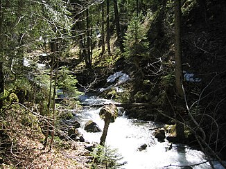
The Dranse de Bellevaux in the forest of Pététoz |
||
| Data | ||
| Water code | FR : V0330500 | |
| location | France , Auvergne-Rhône-Alpes region | |
| River system | Rhone | |
| Drain over | Dranse → Rhone → Mediterranean | |
| source | at Roc d'Enfer , in the municipality of Bellevaux 46 ° 11 ′ 55 ″ N , 6 ° 35 ′ 44 ″ E |
|
| Source height | 1350 m | |
| muzzle | near Bioge , in the municipality of La Vernaz , in the Dranse coordinates: 46 ° 19 ′ 33 ″ N , 6 ° 35 ′ 11 ″ E 46 ° 19 ′ 33 ″ N , 6 ° 35 ′ 11 ″ E |
|
| Mouth height | approx. 530 m | |
| Height difference | approx. 820 m | |
| Bottom slope | approx. 37 ‰ | |
| length | 22 km | |
| Flowing lakes | Lac du Vallon | |
The Dranse de Bellevaux (also called Brevon ) is a mountain river in France that runs in the Haute-Savoie department in the Auvergne-Rhône-Alpes region . It rises near the Roc d'Enfer (2243 m), in the municipality of Bellevaux . First it flows a few kilometers through the forest of Pététoz to the small village of La Chèvrerie , where it forms the small lake Lac de Vallon , which was created by a landslide in 1943 . The river initially drains to the northwest, but then turns to the northeast and flows into the Dranse as a left tributary after 22 kilometers at Bioge , in the municipality of La Vernaz .
Places on the river
Web links
Commons : Dranse de Bellevaux - collection of images, videos and audio files
Remarks
- ↑ The information on the length of the river is based on the information on the relevant website sandre.eaufrance.fr , accessed on September 9, 2009, rounded to the nearest kilometer.
