Ehrenberg (Wasserkuppenrhön)
| Ehrenberg | ||
|---|---|---|
|
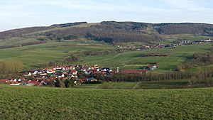
View from the northwest |
||
| height | 816.4 m above sea level NHN | |
| location | at desert saxons ; District of Fulda , Hessen ( Germany ) | |
| Mountains | Rhön | |
| Coordinates | 50 ° 30 '50 " N , 9 ° 59' 24" E | |
|
|
||
The Ehrenberg is 816.4 m above sea level. NHN high mountain in the Rhön .
He is the namesake of the municipality of Ehrenberg in the eastern Hessian district of Fulda and rises roughly in the middle of its district between the districts of Wüstensachsen in the south, Reulbach in the north-west, Seiferts and Thaiden in the north-east and Melperts in the east. The Ehrenberg is the last well-known and over 800 m high elevation of a ridge that stretches from the Wasserkuppe over the Schafstein to the east and northeast and belongs to the Wasserkuppenrhön natural area .
The Ehrenberg is partly forested and partly covered with meadows and pastures, which offer a view, especially to the northwest. For tourism, the Ehrenberg is made accessible by hiking trails of the Rhön Club and local circular hiking trails, which leave the inconspicuous summit in the forest untouched.

