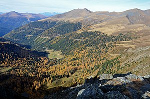
Eisenhut (mountain)
| Monkshood | ||
|---|---|---|
|
Eisenhut from the south ( board height ) |
||
| height | 2441 m above sea level A. | |
| location | Styria , Austria | |
| Mountains | Nockberge , Gurktal Alps | |
| Dominance | 29.2 km → Preber | |
| Notch height | 800 m ↓ Katschberg | |
| Coordinates | 46 ° 57 '11 " N , 13 ° 55' 45" E | |
|
|
||
| rock | Slate , phyllite and tuffite | |
| Age of the rock | Paleozoic | |
| particularities | Highest mountain in the Gurktal Alps | |
The Eisenhut is with a height of 2441 m above sea level. A. the highest mountain of the Nockberge and the Gurktal Alps . It is located northeast of the Turracher Höhe , its summit is in Styria near the border with Carinthia . Its southeastern neighbor is the three-peaked Wintertalernock ( 2333 m , 2404 m , 2394 m ), which forms the border ridge to Carinthia.
The name of the mountain comes from the iron mining that was carried out here in earlier times (see Mining in Turrach ), as evidenced by a mining museum in the nearby village of Turrach . There is a description of the area from the beginning of the 19th century.
A verse from the Carinthian Heimatlied is also dedicated to the monkshood.
Web links
Commons : Eisenhut - Collection of images, videos and audio files
Individual evidence
- ^ Joseph Mitterdorfer: Journey from the Gurkthal in Carinthia to the Flatnizer Alpe and to the great Eisenhut in Steyermark. In: Vaterländische Blätter for the Austrian Imperial State , October 4, 1815, p. 1 (online at ANNO ).

