El Agheila
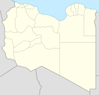
Location of El Agheila in Libya |
al-Agheila ( Arabic العقيلة, also al-Uqaylah or al-Aqaylah ) is a Libyan coastal town at the southernmost point of the Great Syrte, part of the Mediterranean, and the westernmost town in the Kyrenaica region . Until 2007 it belonged to the municipality of Ajdabiya , today it belongs to the municipality of al-Wahat .
El Agheila is known as the theater of the African campaign in World War II .
location
Nearest places are Ras Lanuf (70 km west), Qaryat Bashir , (23 km east) and Brega (Al Burayqah, 45 km east).
history
In the Roman Empire, the Anabucis camp or its Greek predecessor Automala was located at the site of today's settlement .
During the Italian occupation there was a concentration camp for Bedouins in El Agheila . It was located just south of the city and held over 10,000 inmates, thousands of whom died.
The triumphal arch Arco dei Fileni was located west of the village on the Via Balbia coastal road from 1937 to 1970 .
Second World War
In February 1941, El Agheila was captured by British parts of the Western Desert Force after the Italian 10th Army was defeated in Operation Compass . The British stayed there while much of the rest of the Western Desert Force was relocated to Greece to stop the Axis invasion there. This gave the German Africa Corps under Erwin Rommel the opportunity to launch a counter-offensive, which ended with El Agheila being retaken by the Axis powers in March and the British being thrown back to Tobruk and the Egyptian border ( Operation Sunflower ). Rommel had the fortifications of the city reinforced and used them as a base for his operations, especially the siege of Tobruk . After the loss of Tobruk in the course of Operation Crusader in December 1941, El Agheila was the retreat of the Africa Corps, which could also be defended against British attacks.
In January 1942, Rommel began a new operation from El Agheila, which again pushed the British back to Tobruk. The Germans succeeded in taking Tobruk (see Battle of Gazala ) and advancing into Egypt, before they were stopped at El Alamein in July 1942 and finally defeated in November . The Africa Corps was then largely worn out, so that the remaining forces had to leave the city in December 1942 (see Battle of El Agheila ) on the retreat of the advancing British 8th Army .
Individual evidence
- ^ Goodchild, RG (1951) "Boreum of Cyrenaica" Journal of Roman Studies 41 (1/2): pp. 11-16, p. 11
- ↑ The Automala settlement was located on a small hill opposite the island of Bu Sceefa, a few kilometers west of El Agheila. P. 16 in Goodchild, RG (1951) "Boreum of Cyrenaica" Journal of Roman Studies 41 (1/2): pp. 11-16
- ↑ Ham, Anthony (2002) "East of Tripoli - Medinat Sultan to Ajdabiyya: Al-'Aghela" Libya Lonely Planet, London, p. 154, ISBN 0-86442-699-2
Coordinates: 30 ° 16 ' N , 19 ° 12' E

