El Jebel
| El Jebel | ||
|---|---|---|
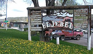
 Road sign on Colorado State Highway 82 |
||
| Location in Colorado | ||
|
|
||
| Basic data | ||
| State : | United States | |
| State : | Colorado | |
| County : | Eagle County | |
| Coordinates : | 39 ° 24 ′ N , 107 ° 5 ′ W | |
| Time zone : | Mountain ( UTC − 7 / −6 ) | |
| Residents : | 3,801 (as of 2010) | |
| Population density : | 218.4 inhabitants per km 2 | |
| Area : | 17.4 km 2 (approx. 7 mi 2 ) of which 17.4 km 2 (approx. 7 mi 2 ) is land |
|
| Height : | 1976 m | |
| Postal code : | 81623 | |
| Area code : | +1 970 | |
| FIPS : | 08-23795 | |
| GNIS ID : | 0174858 | |
El Jebel is a municipality in Eagle County in the US state of Colorado .
The community has 3801 inhabitants (as of 2010) and is located between Carbondale and Basalt near Aspen near the border with Garfield County and Pitkin County . El Jebel is traversed by the Roaring Fork River .
Web links
Commons : El Jebel - collection of images, videos and audio files
