
Garfield County, Colorado
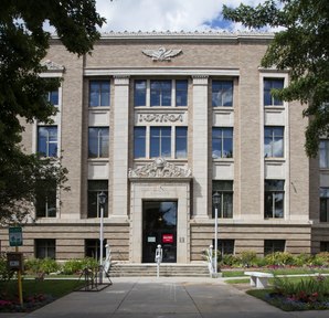 Garfield County Courthouse |
|
| administration | |
|---|---|
| US state : | Colorado |
| Administrative headquarters : | Glenwood Springs |
| Foundation : | |
| Demographics | |
| Residents : | 56,389 (2010) |
| Population density : | 7.4 inhabitants / km 2 |
| geography | |
| Total area : | 7655 km² |
| Water surface : | 23 km² |
| map | |
 |
|
| Website : www.garfield-county.com | |
The Garfield County [ gɑːɹfiːld ] is a county in western US state of Colorado . The county seat is Glenwood Springs .
geography
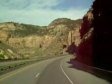
Garfield County is located in the west of Colorado, bordering Utah to the west - in the northeastern part of the Colorado Plateau - comprising a mountainous landscape around the Colorado River . It borders the counties of Rio Blanco in the north, Routt in the northeast, Eagle in the east, Pitkin in the southeast and Mesa in the south.
history
The county was named after James A. Garfield , the 20th US President . It arose in 1883 from most of the Summit district and received its current boundaries in 1889 when the Rio Blanco district emerged in the northwest.
Demographic data
| growth of population | |||
|---|---|---|---|
| Census | Residents | ± in% | |
| 1890 | 4478 | - | |
| 1900 | 5835 | 30.3% | |
| 1910 | 10.144 | 73.8% | |
| 1920 | 9304 | -8.3% | |
| 1930 | 9975 | 7.2% | |
| 1940 | 10,560 | 5.9% | |
| 1950 | 11,625 | 10.1% | |
| 1960 | 12,017 | 3.4% | |
| 1970 | 14,821 | 23.3% | |
| 1980 | 22,514 | 51.9% | |
| 1990 | 29,974 | 33.1% | |
| 2000 | 43,791 | 46.1% | |
| 2010 | 56,389 | 28.8% | |
| Before 1900
1900–1990 2000 2010 |
|||


_source.jpg)

According to the 2000 census , the county had 43,791 people. There were 16,229 households and 11,279 families. The population density was 6 people per square kilometer. The racial the population was composed of 89.96 percent white, 0.45 percent African American, 0.71 percent Native American, 0.44 percent Asian, 0.08 percent of residents from the Pacific island area and 6.53 percent from other ethnic groups Groups; 1.84 percent were descended from two or more races. 16.67 percent of the total population were Hispanic or Latino of any race.
Of the 16,229 households, 37.2 percent had children and adolescents under the age of 18 living with them. 57.6 percent were married couples living together, 7.8 percent were single mothers. 30.5 percent were not families. 22.8 percent were single households and 6.3 percent had people aged 65 or over. The average household size was 2.65 and the average family size was 3.11.
For the entire county, the population was composed of 27.1 percent of residents under 18 years of age, 9.0 percent between 18 and 24 years of age, 33.0 percent between 25 and 44 years of age, 22.1 percent between 45 and 64 years of age 8.8 percent were 65 years of age or over. The median age was 34 years. For every 100 females there were 105.6 males, for every 100 females aged 18 and over there were 105.0 males.
The median income for a household in the 47,016 USD , and the median income for a family was 53,840 USD. Males had a median income of $ 37,554 versus $ 27,280 for females. The per capita income was $ 21,341. 7.5 percent of the population and 4.6 percent of families lived below the poverty line. This included 8.1 percent of the population under the age of 18 and 5.5 percent of the population aged 65 and over.
Places in the district
Not independent cities, but only officially designated places for the census ( census-designated place ) are shown in italics .
Rivers
Individual evidence
- ↑ GNIS-ID: 198138. Retrieved on February 22, 2011 (English).
- ↑ US Census Bureau - Census of Population and Housing . Retrieved March 15, 2011
- ↑ Extract from Census.gov . Retrieved February 28, 2011
- ↑ Excerpt from factfinder.census.gov.Retrieved February 28, 2011
- ↑ Excerpt from census.gov ( memento of the original from July 10, 2011 on WebCite ) Info: The archive link was inserted automatically and has not yet been checked. Please check the original and archive link according to the instructions and then remove this notice. Retrieved March 31, 2012
Web links
List of counties in Colorado
Adams |
Alamosa |
Arapahoe |
Archuleta |
Baca |
Bent |
Boulder |
Broomfield |
Chaffee |
Cheyenne |
Clear Creek |
Conejos |
Costilla |
Crowley |
Custer |
Delta |
Denver |
Dolores |
Douglas |
Eagle |
El Paso |
Elbert |
Fremont |
Garfield |
Gilpin |
Grand |
Gunnison |
Hinsdale |
Huerfano |
Jackson |
Jefferson |
Kiowa |
Kit Carson |
La Plata |
Lake |
Larimer |
Las Animas |
Lincoln |
Logan |
Mesa |
Mineral |
Moffat |
Montezuma |
Montrose |
Morgan |
Otero |
Ouray |
Park |
Phillips |
Pitkin |
Prowers |
Pueblo |
Rio Blanco |
Rio Grande |
Routt |
Saguache |
San Juan |
San Miguel |
Sedgwick |
Summit |
Plate |
Washington |
Weld |
Yuma
Coordinates: 39 ° 36 ' N , 107 ° 54' W