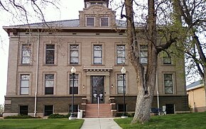
Arapahoe County
| administration | |
|---|---|
| US state : | Colorado |
| Administrative headquarters : | Littleton |
| Foundation : | November 1, 1861 |
| Demographics | |
| Residents : | 572.003 (2010) |
| Population density : | 275 inhabitants / km 2 |
| geography | |
| Total area : | 2086 km² |
| Water surface : | 6 km² |
| map | |
| Website : www.co.arapahoe.co.us | |
Arapahoe County is an administrative unit ( county ) in the northeastern part of the US state Colorado , which extends into the metropolitan area of Denver and Aurora on the west side . The county seat is Littleton .
geography
In addition to the independent city of Denver, Arapahoe borders on the Counties of Adams (as well as Denver until 1902 still under the administration of Arapahoe), Washington , Lincoln , Elbert and Jefferson . The district boundaries between Arapahoe, Denver and Jefferson are very irregular and intertwine around Marston Lake near Littleton (not far from Columbine High School ) so that in some districts the district changes several times. Well within the Denver boundaries, there are still streets that are administratively part of Arapahoe.
Demographic data
| growth of population | |||
|---|---|---|---|
| Census | Residents | ± in% | |
| 1870 | 6829 | - | |
| 1880 | 38,644 | 465.9% | |
| 1890 | 132.135 | 241.9% | |
| 1910 | 10,263 | - | |
| 1920 | 13,766 | 34.1% | |
| 1930 | 22,647 | 64.5% | |
| 1940 | 32,150 | 42% | |
| 1950 | 52.125 | 62.1% | |
| 1960 | 113.426 | 117.6% | |
| 1970 | 162.142 | 42.9% | |
| 1980 | 293,621 | 81.1% | |
| 1990 | 391,511 | 33.3% | |
| 2000 | 487.967 | 24.6% | |
| 2010 | 572.003 | 17.2% | |
| Before 1900
1910-1990 2000 2010 |
|||
The county had a population of 487,967 as of the 2000 census . There were 190,909 households and 125,809 families. The population density was 235 inhabitants per square kilometer. The racial the population was composed of 79.93 percent white, 7.67 percent African American, 0.66 percent Native American, 3.95 percent Asian, 0.12 percent from the Pacific island area and 4.51 percent from other ethnic groups Groups; 3.16 percent were descended from two or more races. Hispanic or Latino of any race were 11.81 percent of the population.
Of the 190,909 households, 34.9 percent had children and young people under the age of 18 living with them. 51.2 percent were married couples living together, 10.6 percent were single mothers. 34.1 percent were not families. 27.0 percent were single households and 5.9 percent had people aged 65 or over. The average household size was 2.53 and the average family size was 3.11.
For the entire county, the population was composed of 26.7 percent of residents under the age of 18, 8.6 percent between 18 and 24 years of age, 33.1 percent between 25 and 44 years of age, and 23.0 percent between 45 and 64 years of age 8.6 percent were 65 years of age or over. The median age was 34 years. For every 100 females there were 97.1 males, and for every 100 females aged 18 and over there were 94.2 males.
The median income for a household in the county is $ 53,570 , and the median income for a family is $ 63,875. Males had a median income of $ 41,601 versus $ 31,612 for females. The per capita income was $ 28,147. 5.8 percent of the population and 4.2 percent of families are below the poverty line. This included 7.0 percent of the population under the age of 18 and 5.1 percent of the population aged 65 and over.
Places in the district
The largest city of Arapahoe is Aurora with around 300,000 inhabitants , which however also falls partly in the counties of Adams and Douglas. The only other major city is Centennial with around 100,000 inhabitants. Places that do not have city rights, but are merely settlement areas defined for statistical purposes ( census-designated place = CDP) are shown in italics .
Individual evidence
- ↑ GNIS-ID: 198118. Retrieved on February 22, 2011 (English).
- ↑ US Census Bureau - Census of Population and Housing . Retrieved March 15, 2011
- ↑ Extract from Census.gov . Retrieved February 14, 2011
- ↑ census.gov (2000) ( Memento of the original from May 22, 2012 in the Internet Archive ) Info: The archive link was inserted automatically and has not yet been checked. Please check the original and archive link according to the instructions and then remove this notice. ( MS Excel ; 26 kB) Accessed March 31, 2012
- ^ Extract from census.gov.Retrieved March 31, 2012
Web links
Coordinates: 39 ° 38 ′ N , 104 ° 20 ′ W


