Custer County, Colorado
| administration | |
|---|---|
| US state : | Colorado |
| Administrative headquarters : | Westcliffe |
| Address of the administrative headquarters: |
PO Box 150 Westcliffe, CO 81252 |
| Foundation : | March 9, 1877 |
| Demographics | |
| Residents : | 4255 (2010) |
| Population density : | 2.2 inhabitants / km 2 |
| geography | |
| Total area : | 1916 km² |
| Water surface : | 3 km² |
| map | |
| Website : www.custercountygov.com | |


Custer County [ ˈkʌstɚ ] is a ( county ) in the southern part of the US state Colorado . The county seat is Westcliffe .
geography
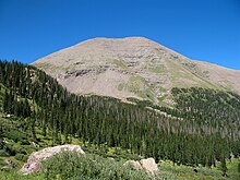
The county is located south of Arkansas in the midst of the rugged mountainous landscape of the Sangre de Cristo and is surrounded by the districts of Fremont in the north, Pueblo in the east, Huerfano in the south and Saguache in the west. Custer County comprises the mountainous region south of Arkansas and northeast of the San Luis Valley in southern Colorado . The only urbanized region is formed by the two neighboring and relatively centrally located small towns of Silver Cliff and Westcliffe in the mountain valley between the Sangre-de-Cristo Mountains and the Wet Mountains at an altitude of around 2,400 meters. On the western border, where the highest mountains of the Sangre de Cristo represent the district boundary to Saguache in the San Luis Valley, lies the Crestone Needle - at 4,325 meters, the highest point of Custer. In the east, Custer has shares in the San Isabel National Forest .
mountains
The administrative district of Custer is completely bordered in the east by the Sangre de Cristo mountains, in which more than 20 four-thousand-meter peaks lie within the district boundaries . The height in meters is given in brackets.
|
|
|
history
Custer County emerged from the southern part of Fremont County in 1877 and has been within its original boundaries ever since. The district honors US General George Armstrong Custer with his name , who died a few months before the administrative unit was founded.
Demographic data
| growth of population | |||
|---|---|---|---|
| Census | Residents | ± in% | |
| 1880 | 8088 | - | |
| 1890 | 2970 | -63.3% | |
| 1900 | 2937 | -1.1% | |
| 1910 | 1947 | -33.7% | |
| 1920 | 2172 | 11.6% | |
| 1930 | 2124 | -2.2% | |
| 1940 | 2270 | 6.9% | |
| 1950 | 1573 | -30.7% | |
| 1960 | 1305 | -17% | |
| 1970 | 1120 | -14.2% | |
| 1980 | 1528 | 36.4% | |
| 1990 | 1926 | 26% | |
| 2000 | 3503 | 81.9% | |
| Before 1900
1900–1990 2000 2010 |
|||
According to the 2000 census , the county had a population of 3,503 people. There were 1,480 households and 1,077 families. The population density was 2 people per square kilometer. The racial the population was composed of 95.89 percent white, 0.37 percent African American, 1.11 percent Native American, 0.29 percent Asian and 0.71 percent from other ethnic groups; 1.63 percent were descended from two or more races. Hispanic or Latino of any race was 2.51 percent of the total population.
Of the 1,480 households, 25.5 percent had children and adolescents under the age of 18 living with them. 64.6 percent were married couples living together, 5.4 percent were single mothers. 27.2 percent were not families. 23.8 percent were single households and 7.9 percent had people aged 65 years or over. The average household size was 2.36 and the average family size was 2.77 people.
For the entire county, the population was composed of 22.5 percent of residents under the age of 18, 4.5 percent between 18 and 24 years of age, 23.3 percent between 25 and 44 years of age, and 35.0 percent between 45 and 64 years of age 14.8 percent were 65 years of age or over. The median age was 45 years. For every 100 females there were 104.3 males, for every 100 females aged 18 and over there were 102.0 males.
The median income for a household in the county is $ 34,731 , and the median income for a family is $ 41,198. Males had a median income of $ 32,460 versus $ 20,868 for females. The per capita income was $ 19,817. 13.3 percent of the population and 9.8 percent of families are below the poverty line. These included 20.1 percent of the population under the age of 18 and 12.6 percent of the population aged 65 and over.
Places in Custer County
In addition to the two small towns Silver Cliff and Westcliffe, two smaller settlements have formed in Custer, which do not have the status of a city, but are only officially designated places for the census ( census-designated place ).
Individual evidence
- ↑ GNIS-ID: 198129. Retrieved on February 22, 2011 (English).
- ↑ US Census Bureau - Census of Population and Housing . Retrieved March 15, 2011
- ↑ Extract from Census.gov . Retrieved February 28, 2011
- ↑ Excerpt from factfinder.census.gov.Retrieved February 28, 2011
- ^ Extract from census.gov.Retrieved March 31, 2012
Web links
Coordinates: 38 ° 5 ′ N , 105 ° 22 ′ W

