El Rama
| El Rama | ||
|---|---|---|
|
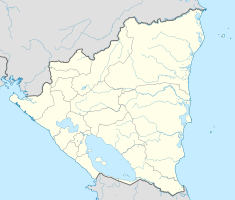
Coordinates: 12 ° 20 ′ N , 84 ° 40 ′ W El Rama on the map of Nicaragua
|
||
| Basic data | ||
| Country | Nicaragua | |
| Department | Autonomous Region of the Costa Caribe Sur | |
| City foundation | December 28, 1910 | |
| Residents | 54,337 (1999) | |
| Detailed data | ||
| surface | 5.618 km 2 | |
| Population density | 9.672 inhabitants / km 2 | |
| height | 10 m | |
| Waters | Río Siquia , Río Mico , Río Rama , Río Escondido , Río La Cusuca | |
| Time zone | UTC −6 | |
| City Presidency | Roger Araica Canales ( PLC ) | |
El Rama is a municipality in the department of Región Autónoma de la Costa Caribe Sur of the Central American country Nicaragua , at the confluence of Río Mico and Río Siguia. The district capital is Ciudad Rama . The municipality extends from the Río Caño Colorado, a tributary of the Río Mahogany , to the Río La Cusuca about 150 kilometers long and 32 kilometers wide.
history
The name was adopted from the Rama (people) ethnic group , who lived in this area on the Río Siquia , Río Mico , Río Rama and Río Escondido to the coast of the Caribbean and were not affected by British pirates and other Europeans who had lived since 1633 to penetrate the Miskito coast , to submit.
Until the incorporation under José Santos Zelaya into the national territory of Nicaragua, there was an alliance of the British and Miskitos which equipped the kingdom of the Miskitos with firearms, with which the other ethnic groups including the Rama were suppressed.
Between 1877 and 1880 the Ciudad Rama was in the river basin southwest of the Río Siquia (Río San Julia), an area which proved to be too susceptible to flooding, which is why the city was moved to its current location.
The district of El Rama was upgraded to Ciudad on December 8, 1910 and the district area was upgraded to Municipio on December 28, 1910. With the incorporation in 1894, the municipality was important for the economy as a supplier of precious wood, natural rubber (Hule) and bananas for US companies. This economic activity led to the influx of workers from the departments of Granada, Boaco and Chontales. With the construction of the 292 kilometer long Carretera Managua - El Rama , the boundary of the agricultural area was pushed into the municipality. Agricultural areas such as Muelle de los Bueyes , Nueva Guinea and Kukra Hill expanded . A Catalan Capuchin from the Vicariate of Bluefiels had a Catholic church built in Ciudad Rama in 1915 .
Many people settled again between 1920 and 1945, often collecting rubber and cutting trees. Another influx took place between 1950 and 1974 - mechanization, capitalization and extensification of agriculture for export production such as cotton and sugar cane had often driven them from other parts of the country, and now they tried to raise cattle on the cleared areas.
Between 1950 and 1978 Nicaragua had annual growth rates of almost five percent in the agricultural sector. Agricultural export production increased: cotton, meat, sugar and coffee, respectively by 500%, 377%, 250% and 151%. The development of staple food grains developed comparatively moderately with an increase of 60% in the same period, since this production was industrialized to a comparatively small extent and therefore not competitive on the world market.
Individual evidence
- ↑ Page no longer available , search in web archives: FICHA MUNICIPAL El Rama (PDF; 266 kB)
