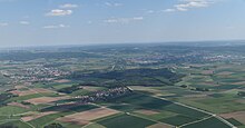
Ellinger Forest
The Ellinger Forest is a contiguous forest area southwest of the eponymous city of Ellingen in the central Franconian district of Weißenburg-Gunzenhausen . It is located between the villages of Massenbach and Schmalwiesen . Located in the Altmühltal Nature Park and in the southern part of the Franconian Lake District, the area is made up of the actual Ellinger Forest in the center, the woodland meadows and Schmalwiesenholz in the south and the Dürren Lohe in the north.
Federal highway 2 and the Treuchtlingen – Nuremberg railway line run to the east, and federal highway 13 runs to the north and partly through the forest . There are two prehistoric burial mounds in the area . The forest area is traversed by the Mittelbühlgraben , to the south the Himmelreichgraben flows past. The highest point of the forest is at an altitude of 439.9 m above sea level. NN . The Ellinger Forest lies entirely in the nature reserve Schutzzone in the Altmühltal nature park . As a popular hiking area, the forest is criss-crossed by several hiking trails.
Individual evidence
- ↑ BayernViewer-denkmal maps of the Bavarian State Office for Monument Preservation , monument number D-5-6931-0096
- ↑ Topographic Maps , Bavarian Surveying Administration
- ↑ according to BfN map
Coordinates: 49 ° 3 ′ 18.6 ″ N , 10 ° 56 ′ 48.5 ″ E
