Elst (Utrecht)
| province |
|
| local community |
|
| Residents | 4,465 (Jan 1, 2017) |
| Coordinates | 51 ° 59 ′ N , 5 ° 30 ′ E |
| Important traffic route |
|
| prefix | 0318 |
| Postcodes | 3911, 3921-3922, 4051 |
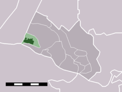
| Location of Elst in the municipality of Rhenen | |

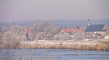
The Elsterberg (63 m above sea level ) lies north of Elst
Elst is a village in the Dutch municipality of Rhenen , Utrecht province . In 2017 the place had 4465 inhabitants.
Elst is on the Nederrijn and borders the Utrechtse Heuvelrug National Park .
There is a ferry across the Nederrijn to the way to the village of Ingen in the Gelders municipality of Buren .
Web links
Commons : Elst - collection of images, videos and audio files
Individual evidence
- ↑ a b Kerncijfers wijken en buurten 2017 Centraal Bureau voor de Statistiek , accessed on April 2, 2018 (Dutch)

