
Nederrijn


The Nederrijn is the northern arm of the Rhine in the Rhine-Maas Delta in the Netherlands .
The name “Niederrhein” would be translated into German, but the Nederrijn must not be confused with the Niederrhein , as the lower North Rhine-Westphalian section of the Rhine is called in Germany up to the state border. Upon reaching the German border at Spijk the Rhine is Dutch here Boven-Rijn called ( "Upper Rhine") - and flows in Tolkamer in Bijlands channel that an old loop (now Oude Waal called) of the Waal cuts, the southern main arm of the stream. Because at the previous fork in both main arms near Tolkamer, the former first Nederrijn section was also dammed (as Oude Rijn or Rijnstrangen today, with its silting oxbow lakes, a nature reserve). At the end of the 3 km long Bijlands Canal near Millingen , the water of the Rhine is distributed over the Waal, which now begins here, and the 6 km long Pannerdens Canal , which feeds a third of the central waterway into the Nederrijn.
Today, the Nederrijn forms the continuation of the Pannerden Canal (since 1706), southeast of Arnhem from Angeren , before the IJssel branches off .
From Wijk bij Duurstede near Utrecht the river is called Lek , and at Krimpen aan de Lek it joins the Noord . Both flow through the port of Rotterdam as the Nieuwe Maas and flow into the North Sea via the Nieuwe Waterweg near Hoek van Holland .
In order to regulate the drainage of the various river arms, dam and lock complexes have been built near Driel and Amerongen . The water level of the IJssel (Gelderland) is regulated with the weir in Driel .
Already between 1530 and 1536 the course of the Rhine near Arnhem was changed so that the city came to rest on the river. As a result, the city, which was built on the Sint-Jansbeek brook , was not only able to defend itself better in the Geldrian feuds , but also to develop sustainably thanks to improved trade routes. Arnhem is now the largest city on the Nederrijn.
At bridges over the Nederrijn there are three road bridges and one railway bridge at Arnhem, the motorway bridge ( A50 ) at Heteren and a road bridge at Rhenen . Ferries operate at Doorwerth , Wageningen , Opheusden , Elst and Amerongen .
gallery
Nederrijn at Renkum
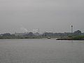
Nederrijn near Arnhem

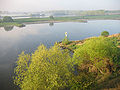
the last part of the Nederrijn, near Wijk bij Duurstede


See also
Web links
Coordinates: 51 ° 58 ′ 13.8 " N , 5 ° 44 ′ 36.3" E