Hook of Holland
 flag |
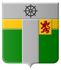
 coat of arms |
| province |
|
| local community |
|
|
Area - land - water |
18.66 km 2 14.34 km 2 4.32 km 2 |
| Residents | 10,200 (Jan. 1, 2017) |
| Coordinates | 51 ° 59 ′ N , 4 ° 8 ′ E |
| Important traffic route |
|
| prefix | 0174 |
| Postcodes | 2676, 2678, 2681, 2691, 3141, 3151 |
| Website | Homepage of Hook of Holland |
| Location of the Hoek van Holland district in Rotterdam | |
Hoek van Holland ( ) ( German corner of Holland ) is now a district of Rotterdam , but has retained the character of a small coastal town and seaside resort. It is located in South Holland at the main mouth of the Rhine . This current section of the Rhine is from river historical reasons but here Oude Maas (Old Meuse) and became in 1872 the so-called New Waterway (New Waterway) expanded. Neighboring cities are Monster , 's-Gravenzande and Naaldwijk in the north-west and Maassluis in the south-east. On the other side of the river are the Europoort and Maasvlakte .
Hook of Holland has an area of 18.66 km²; of which 14.34 km² are mainland. On January 1, 2017, the place had 10,200 inhabitants.
traffic
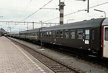
Hoek van Holland was and is one of the most important ferry ports on the connection from mainland Europe to Great Britain . The passenger station directly at the ferry terminal has therefore been the destination of long-distance trains from Central Europe such as the Berlin-London Express , the Rheingold , the Austria Express and the Holland-Scandinavia Express for decades . Rail traffic on the Schiedam route has been suspended since April 1, 2017 , and the route is being converted into a metro route for the Rotterdam Metro .
On February 21, 1907, the British passenger ship Berlin sank in a severe storm on the northern pier ; 168 people were killed in the accident.
In addition to the rail connection, the place also has a direct motorway connection as part of Europastraße 30 . There are currently two direct ferry connections (one day and one night ferry) with the shipping company Stena Line to Harwich in Essex , England, and a truck ferry connection to Killingholme in Lincolnshire , England.
A local RET ferry provides a regular connection with the port of Rotterdam .
Web links
- Municipality website (Dutch, German, English)
Individual evidence
- ↑ a b Kerncijfers wijken en buurten 2017 Centraal Bureau voor de Statistiek , accessed on June 10, 2018 (Dutch)
- ↑ Otto Mielke: Disasters at Sea. Gerhard Stalling Oldenburg, Hamburg 1957


