Emsdettener Mühlenbach
|
Emsdettener Mühlenbach (upper reaches: Wipperbach , Brüggemannsbach , Neuer Graben ) |
||
|
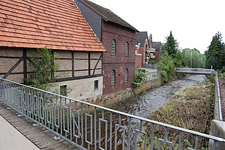
The Emsdettener Mühlenbach in Emsdetten |
||
| Data | ||
| Water code | EN : 336 | |
| location | North Rhine-Westphalia , Germany | |
| River system | Ems | |
| source |
Emsdetten -Hollingen 52 ° 3 '53 " N , 7 ° 27' 57" O |
|
| Source height | 71 m above sea level NN | |
| muzzle | In Emsdetten in the Ems coordinates: 52 ° 10 ′ 50 ″ N , 7 ° 32 ′ 40 ″ E 52 ° 10 ′ 50 ″ N , 7 ° 32 ′ 40 ″ E |
|
| Mouth height | 35 m above sea level NN | |
| Height difference | 36 m | |
| Bottom slope | 1.8 ‰ | |
| length | 19.6 km | |
| Catchment area | 107.865 km² | |
The Emsdettener Mühlenbach is a left tributary of the Ems in Emsdetten . It has a length of 19.585 kilometers and a catchment area of 107.865 square kilometers.
geography
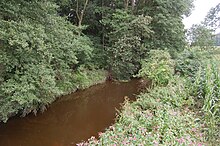
Several spring brooks that drain the Buchenberg in Steinfurt merge with the Schwienebach in Emsdetten-Hollingen, which is irrigated by the Altenberger Ridge, to form the Emsdettener Mühlenbach. The stream crosses the historic Max-Clemens-Canal and was named Linteler Beke here in 1724 .
After a few kilometers, the Mühlenbach reaches the urban area of Emsdetten in the south, flows from here in a north-easterly direction through the city center and finally flows into the Ems in the north of the city .
The gradient of the stream and the amount of water that it runs, which is sufficient for most of the year, enabled four mills to operate in the Emsdetten urban area, which gave the stream its name.
The Mühlenbach as part of the Regionale 2004
As a local project called "WasserWege" within the framework of the Regionale 2004 , large parts of the previously straightened stream in the city of Emsdetten have been renatured, cycle and footpaths have been created along its course and direct access to the water has been made possible again in many places. In the course of this, two new pedestrian bridges were also built, which connect the eastern urban area more closely to the city center.
The mouth area of the Mühlenbach was also developed close to nature; In the long term, a natural alluvial forest should be formed again here in the Emsauen .
swell
- NRW Ministry for Climate Protection, Environment, Agriculture, Nature and Consumer Protection
- Regional Association of Westphalia-Lippe
- Westphalian Heimatbund
- Archive NRW (Max-Clemens-Kanal) www.archive.nrw.de
Individual evidence
- ↑ a b German basic map 1: 5000
- ↑ a b Topographical Information Management, Cologne District Government, Department GEObasis NRW ( Notes )


