Ernst Heinrich Michaelis
Ernst Heinrich Michaelis (* 1794 in Schönenberg near Elbing ; † 1873 in Berlin-Schöneberg ) was a Prussian officer and geographer .
life and work
Ernst Heinrich Michaelis was the son of a preacher and attended high school in Danzig . Later he worked for the Prussian General Staff and from 1817 for Alexander von Humboldt's Atlas geographique et physique du Nouveau Continent . He was also an employee of the geographic magazine Hertha von Heinrich Berghaus . From 1824 Michaelis worked as a cartographer for Johann Friedrich Cotta in Stuttgart and traveled to Switzerland for the first time in 1827 to study .
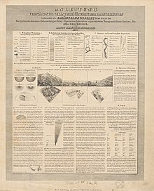
Michaelis probably settled in Aarau around 1834 and had contact with Guillaume Henri Dufour . The canton of Aargau was surveyed from 1837 to 1843 under the direction of Michaelis . This resulted in the so-called Michaeliskarte . This was the basis for the Swiss Dufour card . While he was still working on the canton map, Michaelis published the works Passage du Splügen et de la Via mala 1846/47 and the Carte du Canton du Tessin et des Environs de Milan , which shows decisive progress compared to all previous Ticino maps. In 1845 Michaelis published his study on the representation of the high mountains in topographic maps .
Michaelis later lived in Freiburg im Breisgau and Berlin, where he died in the sanatorium in Schöneberg.
literature
- Charles Tschopp: Ernst Heinrich Michaelis (1794–1873). In: Argovia , annual journal of the Historical Society of the Canton of Aargau, Vol. 68–69, 1958, pp. 543–545 ( digitized version ).
- Urban Schertenleib : Ernst Heinrich Michaelis. In: Historical Lexicon of Switzerland . November 10, 2009 .
Web links
- Ernst Heinrich Michaelis in the German biography
- Ernst Heinrich Michaelis (1794–1873) In: WorldCat
- Information on the Michaeliskarte Aargau Geographical Information System (AGIS)
- Ernst Heinrich Michaelis. Surveying the landscape. in Canton Aargau
Individual evidence
- ^ Charles Tschopp: 1834, Michaelis and Guillaume Henri Dufour. Retrieved August 16, 2020 .
| personal data | |
|---|---|
| SURNAME | Michaelis, Ernst Heinrich |
| BRIEF DESCRIPTION | Prussian officer and geographer |
| DATE OF BIRTH | 1794 |
| PLACE OF BIRTH | Schönenberg near Elbing |
| DATE OF DEATH | 1873 |
| Place of death | Berlin-Schöneberg |
