Escalante (Utah)
| Escalante | ||
|---|---|---|
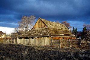
 An old building in Escalante |
||
| Location in Utah | ||
|
|
||
| Basic data | ||
| Foundation : | 1875 | |
| State : | United States | |
| State : | Utah | |
| County : | Garfield County | |
| Coordinates : | 37 ° 46 ′ N , 111 ° 36 ′ W | |
| Time zone : | Mountain ( UTC − 7 / −6 ) | |
| Residents : | 818 (status: 2000) | |
| Population density : | 107.6 inhabitants per km 2 | |
| Area : | 7.6 km 2 (approx. 3 mi 2 ) of which 7.6 km 2 (approx. 3 mi 2 ) is land |
|
| Height : | 1774 m | |
| Postal code : | 84726 | |
| Area code : | +1 435 | |
| FIPS : | 49-23750 | |
| GNIS ID : | 1440956 | |
Escalante is a city in Garfield County in Utah , United States . In 2000 it had 818 inhabitants. The city was named after Silvestre Vélez de Escalante , a Spanish missionary who was the first European to explore the area. Escalante has an area of 7.6 km².
geography
The Calf Creek Canyon and the Grand Staircase-Escalante National Monument lie between Escalante and the nearby boulder .
tourism
Escalante is the starting point for hikes in the Grand Staircase-Escalante National Monument.
traffic
Utah State Route 12 runs through the town . Escalante also has a regional airport, Escalante Municipal Airport.
Others
Escalante draws its medical care from surrounding Garfield County.
Web links
Commons : Escalante - collection of images, videos and audio files
- Web site Escalante (English)
Individual evidence
- ↑ http://garfield.utah.gov/?q=node/12 (English)
