Falkenstein (Frankenfels)
| Falkenstein | ||
|---|---|---|
|
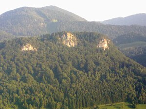
The Falkenstein Wall, photographed from the Berg homestead on the Frankenfelsberg |
||
| height | 720 m above sea level A. | |
| location | southeast of Frankenfels , Lower Austria | |
| Mountains | Türnitz Alps | |
| Dominance | 0.65 km → Sonnberg | |
| Coordinates | 47 ° 58 '46 " N , 15 ° 20' 4" E | |
|
|
||
| rock | limestone | |
| particularities | Climbing area | |
The Falkenstein is a 720 m above sea level. A. high mountain near the market town of Frankenfels in Lower Austria . It is considered a good vantage point and is particularly known for its north-west rock faces, the Falkenstein Wall, which are a popular climbing area.
Location and access
The Falkenstein is located east of the center of Frankenfels. A flat, agriculturally used summit plateau extends above the steep Falkenstein wall facing the village. The high plateau is at an altitude of 720 m above sea level and offers an excellent view of the village of Frankenfels, the Frankenfelsberg opposite and the Natterstal. You can reach the vantage point southwest from Markt Frankenfels via the Guten Hirten or northeast from the Pielachleiten area via Nattershof and Vorder-Höhenberg. The Pielachtaler Bahnwanderweg on the Mariazellerbahn from Gösing to Kirchberg an der Pielach also leads over the Falkenstein wall , as does the Große Pielachtaler Rundwanderweg 652 .
Climbing area Falkensteinmauer
The Falkenstein wall is a three-part wall that ends on the summit plateau. The rock consists of gray limestone in various shapes and forms.
With a rock height of seven to 80 m, it is the largest rock face in the Pielach Valley and also the symbol of Frankenfels. The wall is important as a hiking destination and also as a climbing area. There are around 150 routes in five sectors ranging from IV- to X + (UIAA) . From slab climbing to wall climbing with an overhang of up to seven meters, all levels of difficulty can be found.
Others
The name of the hamlet of Falkensteinrotte , located around the 952 m high Sonnberg (formerly called Hehenberg or Höhenberg), is derived from the Falkenstein farmstead (Falkensteinrotte 3), located southeast of the wall.
literature
- Bernhard Gamsjäger and Ernst Langthaler (eds.): Das Frankenfelser Buch , Frankenfels 1997.
Individual evidence
- ^ Bernhard Gamsjäger: Frankenfelser Häuserbuch , Frankenfels 1987, page 24

