Fara (island)
| Fara | |
|---|---|
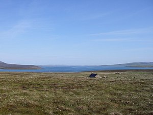
| Abandoned house on Fara | |
| Waters | North Sea |
| Archipelago | Orkney Islands |
| Geographical location | 58 ° 50 '41 " N , 3 ° 9' 58" W |
| surface | 2.95 km² |
| Residents | uninhabited |
The island of Fara (Foerey - "Sheep Island") belongs to the Orkney archipelago about 30 km north of Scotland . In the archipelago, it lies between the islands of Hoy and Flotta in the bay of Scapa Flow . The island is 295 hectares and has been uninhabited since 1947.
In World War II rose from here barrage balloons on.
The 2010 wind energy project provides for the construction of wind turbines on Fara.
literature
- Charles Tait: The Orkney Guide Book. Edition 2.1. C. Tait, Kelton - St. Ola - Orkney 1999, ISBN 0-9517859-0-7 , p. 167.
- John R. Hunter, Stephen J. Dockrill, Jacqueline I. McKinley: The Sites and Monuments of Fara, Orkney (= Bradford University School of Archaeological Sciences Occasional Papers. No. 1). School of Archaeological Sciences - University of Bradford, Bradford 1982.


